Knoxville Maps and Orientation
(Knoxville, Tennessee - TN, USA)
A medium-sized city located on the northeastern side of Tennessee, close to
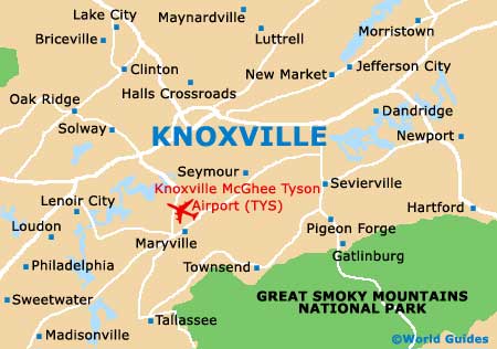
Gatlinburg, Knoxville lies directly to the north of the Great Smoky Mountains National Park. The city serves as the state's third-biggest and as the county seat of Knox.
Knoxville resides within the famous Great Appalachian Valley, which is often referred to as the Tennessee Valley, with the Cumberland Plateau being found to the west. Notable natural structures in this area include Beaver Ridge, Brown Mountain and Sharp's Ridge, as well as sections of both the Bays Mountain and the McAnnally Ridge.
Downtown Knoxville is divided by the Tennessee River, which begins its journey on the southeasterly side of the city, where it meets the Holston River.
Maps and Orientation of the City
There are five main zones that make up Knoxville, namely the downtown district and also the north, east, south and west zones. Each of these areas comprise a series of neighborhoods, such as those of Bearden, Chilhowee Park, Emory Place, Fort Sanders, Fountain City, Lonsdale, Mechanicsville, Morningside, North Hills, Oakwood-Lincoln Park, Old City, Parkridge and Rocky Hill.
The Knoxville Visitors Center is a good place to source city and state maps, being situated on South Gay Street, close to Market Square and the Crowne Plaza Hotel. Both the Knoxville City Hall and the Lincoln Memorial University reside just a couple of blocks to the west.
- Beaumont - 3 miles / 5 km (ten minutes, north)
- Belle Morris - 3 miles / 5 km (ten minutes, north)
- Chattanooga - 112 miles / 180 km (two hours and 35 minutes, southwest)
- Eagleton Village - 14 miles / 23 km (25 minutes, south)
- Edgewood - 3 miles / 5 km (ten minutes, north)
- Gatlinburg - 38 miles / 61 km (one hour, southeast)
- House Mountain State Natural Area - 16 miles / 26 km (30 minutes, northeast)
- Karns - 13 miles / 21 km (25 minutes, west)
- Lakeshore Park - 5 miles / 8 km (12 minutes, southwest)
- Morningside - 2 miles / 3 km (eight minutes, east)
- Palisades Condominiums - 12 miles / 19 km (20 minutes, southwest)
- Park City - 3 miles / 5 km (ten minutes, northeast)
- Powell - 10 miles / 16 km (20 minutes, northwest)
- Rockford - 12 miles / 19 km (20 minutes, south)
- Seven Islands Wildlife Refuge - 16 miles / 26 km (30 minutes, east)
- Seymour - 12 miles / 19 km (20 minutes, southeast)
- Vestal - 3 miles / 5 km (ten minutes, south)
- Victor Ashe Park - 7 miles / 11 km (15 minutes, west)
Map of the United States

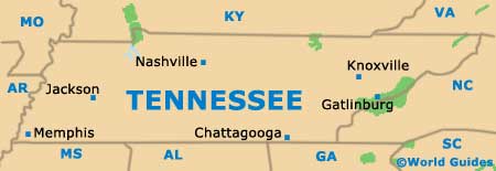
Map of Tennessee
Map of Knoxville