Detroit Maps and Orientation
(Detroit, Michigan - MI, USA)
A city with a noticeable fresh urban energy and a friendly vibe, Detroit has turned into a handsome city following much regeneration and numerous building projects - including the imposing Renaissance Center. The seat of Wayne County, Detroit resides within the state of Michigan where it is the largest city, although it is not actually the state capital - that title has been awarded to the considerably smaller city of
Lansing, some 90 miles / 145 km to the west.
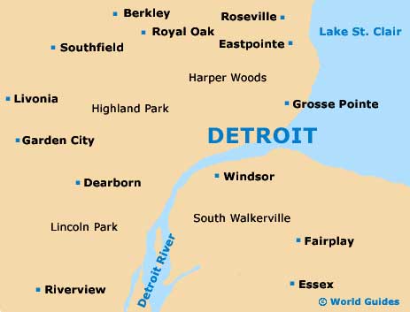
Sightseers will likely want to tour the main districts to get a bearing of Detroit's layout, namely Bricktown, the Cultural Center, Midtown and the New Center, as well of course as the Downtown district and its appealing Rivertown area. Another neighborhood of note is Mexicantown, which is sited roughly 3 miles / 5 km to the west of Downtown and offers a high concentration of affordable Mexican eateries.
Located to the west of Woodward Avenue, the University District forms the most elevated part of the city and is called home by the University of Detroit Mercy (UDM), an important co-educational institution founded all the way back in the 1870s.
Maps and Orientation of the City
The city of Windsor, in the Canadian province of
Ontario, lies just across the Detroit River, where it is often referred to as 'The City of Roses'. Further afield, it is possible to reach
Toronto (northeast) in less than five hours by road.
Standing on West Fort Street, close to both the Cobo Center and the Hart Plaza, the Detroit Metro Convention and Visitors Bureau is a good place to obtain city maps.
- Ann Arbor - 43 miles / 69 km (one hour and five minutes, west)
- Eastpointe - 16 miles / 26 km (25 minutes, north)
- Farmington Hills - 28 miles / 45 km (45 minutes, northwest)
- Leamington - 61 miles / 98 km (one hour and 35 minutes, southeast)
- Livonia - 20 miles / 32 km (35 minutes, west)
- Monroe - 40 miles / 64 km (one hour, southwest)
- Pontiac - 31 miles / 50 km (45 minutes, northwest)
- Rochester Hills - 26 miles / 42 km (40 minutes, north)
- Roseville - 15 miles / 24 km (25 minutes, north)
- Royal Oak - 14 miles / 23 km (20 minutes, northwest)
- Southfield - 15 miles / 24 km (25 minutes, northwest)
- Sterling Heights - 25 miles / 40 km (40 minutes, north)
- Taylor - 18 miles / 29 km (30 minutes, southwest)
- Warren - 17 miles / 27 km (25 minutes, north)
- Waterford - 36 miles / 58 km (50 minutes, northwest)
- Woodhaven - 20 miles / 32 km (35 minutes, southwest)
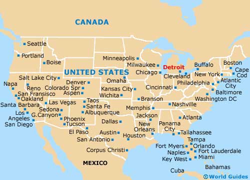
Map of the United States
Map of Michigan

Map of Detroit