Edmonton Maps and Orientation
(Edmonton, Alberta - AB, Canada)
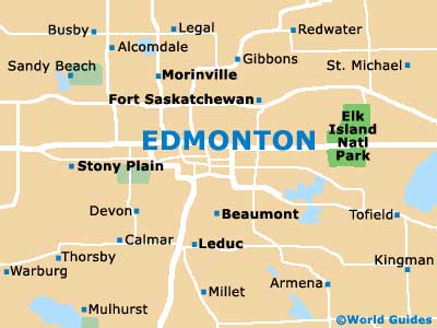
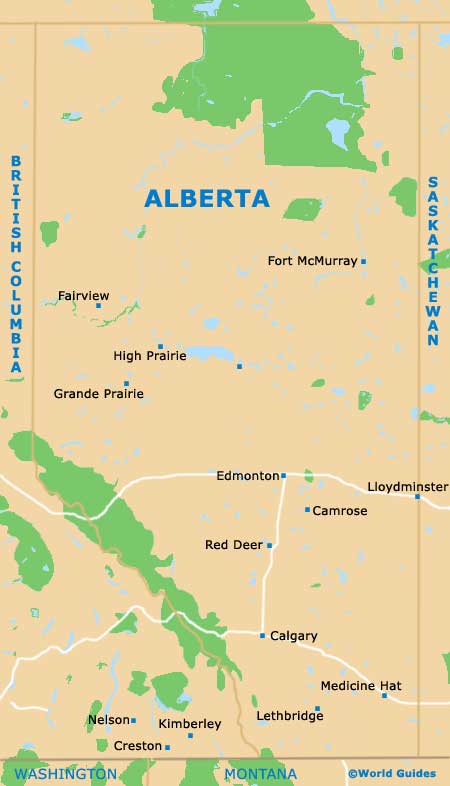
One of the most northerly cities in the whole of Canada, Edmonton is situated within the province of Alberta (AB), where it has long been the capital city. Central Edmonton lies on the westerly banks of the North Saskatchewan River, while both the Low Level Bridge and the James McDonald Bridge link the attractions to the east.
Much of the terrain surrounding Edmonton is flat, comprising a series of scenic ravines and river valleys, such as the magnificent North Saskatchewan River Valley. Those wishing to pay a visit to the Canadian Rockies will find them around approximately 137 miles / 220 km to the south-west.
Maps and Orientation of the City
Many visitors find getting around central Edmonton a little confusing, since maps can make the arrangement of streets look rather complicated. However, the city center is actually quite easy to navigate, with all avenues running in an east to west direction and numbered accordingly, with the numbers rising as you head northwards.
Worth noting is the way that addresses are written in Edmonton, with building numbers often being added to the street numbers, e.g. '10020 - 104th Avenue' actually means building number 20 on 100th Street, at the junction with 104th Avenue.
Map of Canada

Map of Alberta
Map of Edmonton