Trujillo Maps and Orientation
(Trujillo, La Libertad, Peru)
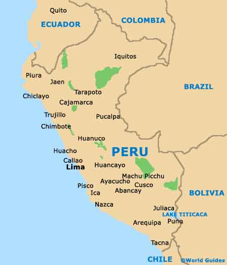
Located on the north-westerly coastline of
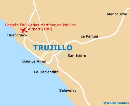
Peru and particularly close to the port town of Salaverry, Trujillo lies directly north of Chimbote and within the La Libertad region, where it is the capital city. Trujillo stands alongside the Moche River and right next to the South Pacific Ocean.
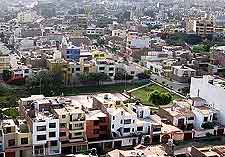
With a population not far from 800,000 people, the city was founded in 1534, when it was previously known as the Villa Trujillo. Today, the city has grown to become a prominent Peruvian economic centre and World Heritage Site, and is surrounded by large expanses of agricultural farmland.
Maps and Orientation of the City
Trujillo is a good place to base yourself if you are planning to explore this part of northern Peru. The acclaimed Huanchaco Beach is just a short drive to the north, where it has become nothing short of a major surfing hotspot, drawing crowds of beachgoers each year.
The Pan-American Highway is an important local road, which connects Trujillo to many neighbouring coastal cities with relative ease. Landmarks in the centre of Trujillo include the Mercado Central and also the Plaza de Armas, where the convenient iPeru tourist office is located - a good source of regional and city maps. The Plaza de Armas is bounded by the roads of the Almagro, the Independencia, the Orbegoso, and the Pizarro.
- Cajabamba - north-east
- Cajamarca - north-east
- Carhuaz - south-east
- Chachapoyas - north-east
- Chiclayo - north
- Chimbote - south
- Huacho - south
- Huanchaco - north-west
- Huanuco - south-east
- Huaraz - south-east
- Otuzco - north-east
- Pacasmayo - north
- Salaverry - south
- Santa Lucia - east
- Tortugas - south
- Yungay - south-east
Map of Peru
Map of Trujillo