Florianopolis Maps and Orientation
(Florianopolis, Santa Catarina, Brazil)
Situated on the southern side of
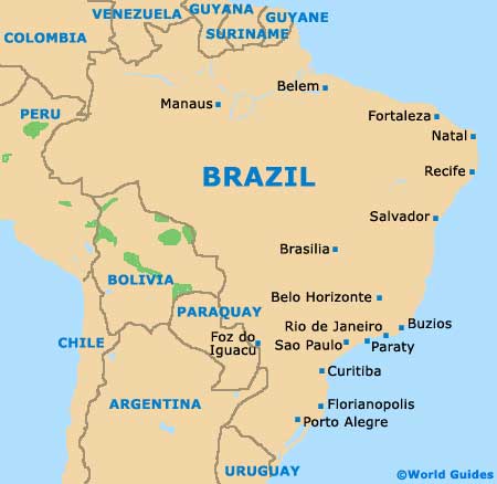
Brazil, within the state of Santa Catarina, Florianopolis is the proud state capital and has a population of just over 400,000 people. The majority of Florianopolis is comprised of the island of Santa Catarina, known to Brazilians as the Ilha de Santa Catarina, while the districts of Coqueiros and Estreito stand on the mainland. A number of surrounding islands are also considered to be a part of this city.
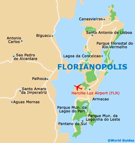
The historic centre of Florianopolis is based on the island of Santa Catarina, together with the trendy neighbourhood of Beira-Mar Norte, with these two districts being connected by bridges.
Maps and Orientation of the City
Most will agree that the island can be treated as two main sectors. The northern side of Florianopolis tends to be favoured by sightseers and maintains a comprehensive tourist infrastructure. The south remains a more local area, with a strong Portuguese character and colonial architecture celebrating its history, when settlers arrived from the Archipelago of Azores and also
Madeira.
Central Florianopolis is where you will find the spacious public square named the Praca XV de Novembro, together with an impressive fig tree planted more than 100 years ago. Maps of Florianopolis are not always easy to come by, with the best outlets including the long-distance bus station and also the Convention and Visitors Centre, which stands on the Rua Jeronimo Coelho.
- Aguas Mornas - 39 km / 24 miles (55 minutes, west)
- Angelina - 63 km / 39 miles (one hour and 20 minutes, west)
- Anitapolis - 97 km / 60 miles (one hour and 55 minutes, south-west)
- Antonio Carlos - 35 km / 22 miles (45 minutes, west)
- Biguacu - 21 km / 13 miles (30 minutes, north-west)
- Garopaba - 72 km / 45 miles (one hour and 30 minutes, south)
- Governador Celso Ramos - 50 km / 31 miles (one hour and five minutes, north)
- Imbituba - 92 km / 57 miles (one hour and 45 minutes, south)
- Itapema - 69 km / 43 miles (one hour and 25 minutes, north)
- Major Gercino - 88 km / 55 miles (one hour and 40 minutes, north-west)
- Palhoca - 19 km / 12 miles (25 minutes, west)
- Paulo Lopes - 56 km / 35 miles (one hour and ten minutes, south)
- Santo Amaro da Imperatriz - 31 km / 19 miles (40 minutes, west)
- Sao Bonifacio - 80 km / 50 miles (one hour and 40 minutes, south-west)
- Sao José - 9 km / 6 miles (15 minutes, west)
- Sao Pedro de Alcantara - 35 km / 22 miles (45 minutes, west)
- Tijucas - 52 km / 32 miles (one hour and five minutes, north)
Map of Brazil
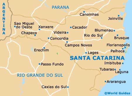
Map of Santa Catarina
Map of Florianopolis