Cordoba Maps and Orientation
(Cordoba, Andalucia, Spain)
A fairly large Spanish city with a population in the region of 350,000 people, Cordoba resides on the south-western side of the country, within the autonomous community of Andalucia (also spelt Andalusia).
Capital of the province of the same name, this city has ancient origins and is reputed to have been the most densely populated city in the entire world during the 10th century, when it was an important educational hub led by Islamic rulers. Cordoba remains a city of culture and history, with its expansive Old Town area being named a World Heritage Site in 1984.
Cordoba grew up around the Guadalquivir River and this sizeable waterway is a useful reference point on maps of Andalucia. The city is within close proximity to the Sierra Morena mountain range, which serves as a boundary for the municipal area and has provided a significant mining resource for the city over the centuries.
Maps and Orientation of the City
Maps of Cordoba are available from the various tourist information points dotted around the city. These include the RENFE train station on the Glorieta de las Tres Culturas (just off the Avenida de la Via Augusta), and the tourism outlet on the Plaza de las Tendillas, known locally as the Patronato Provincial de Turismo.
For tourists, the winding maze of medieval streets around the Mezquita provide much of the interest. The Old Town of Cordoba is to be found a little uphill from the Guadalquivir River, while the Jewish Quarter sits on the northern and western sides of the Mezquita.
- Alcolea - 10 km / 6 miles (15 minutes, east)
- Andujar - 80 km / 50 miles (one hour and ten minutes, east)
- Antequera - 115 km / 71 miles (one hour and 35 minutes, south)
- Cabra - 79 km / 49 miles (one hour and ten minutes, south)
- Castro del Rio - 44 km / 27 miles (50 minutes, south-east)
- El Carpio - 34 km / 21 miles (45 minutes, east)
- El Higueron - 8 km / 5 miles (12 minutes, west)
- Espejo - 36 km / 22 miles (45 minutes, south-east)
- Fernan Nunez - 30 km / 19 miles (40 minutes, south)
- Granada - 180 km / 112 miles (three hours, south-east)
- Jaén - 110 km / 68 miles (one hour and 30 minutes, east)
- La Carlota - 34 km / 21 miles (45 minutes, south)
- Lucena - 71 km / 44 miles (one hour and five minutes, south)
- Malaga - 155 km / miles (two hours and 30 minutes, south)
- Montilla - 46 km / 29 miles (55 minutes, south)
- Montoro - 47 km / 29 miles (55 minutes, north-east)
- Obejo - 43 km / 27 miles (50 minutes, north)
- Pedro Abad - 38 km / 24 miles (45 minutes, east)
- Posadas - 31 km / 19 miles (40 minutes, west)
- Seville - 140 km / 87 miles (two hours and 15 minutes, south-west)
- Villafranca de Cordoba - 31 km / 19 miles (40 minutes, east)
Map of Spain

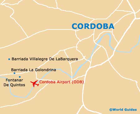
Map of Cordoba