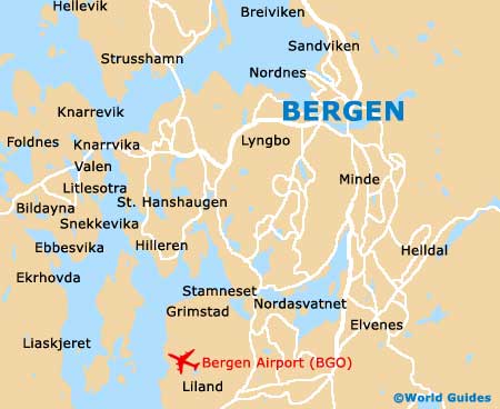
Bergen Maps and Orientation
(Bergen, Hordaland, Norway)
A large and spreading city within the county of Hordaland and the Midhordland district, Bergen lies on the south-western side of
Norway and boasts a population of around a quarter of a million inhabitants. Currently Norway's second-largest city, Bergen was actually once the country's biggest until the early part of the 19th century, when the rapidly expanding
Oslo soon overtook it in both size and overall population.
The city occupies much of Norway's Bergen Peninsula, and is close to a series of islands, which include Askoy, Holsnoy and Sotra. Central Bergen is actually surrounded by a group of seven mountains known as the 'de syv fjell', and these have become an iconic symbol of the city, dominating many views and regularly appearing on postcards.
Maps and Orientation of the City
An especially historical part of Bergen is the inner harbour area of Vagen, which lies on the northern side of the bay, surrounded by pretty alleyways and many leading tourist sites. Other significant areas include Bryggen, which has a definite medieval character, despite many of the buildings being rebuilt in the 18th century following considerable fire damage.
Free maps of Bergen are available all around the city, at newsagents, bookstores, hotels, and from both the bus and railway stations, on the Stromgaten. The Bergen Reiselivslag Tourist Office on the Vagsallmenningen provides a useful free guide booklet to the city, which features a good map of the city centre, indicating the main places of interest.
- Austrheim - 67 km / 42 miles (one hour and 15 minutes, north)
- Fusa - 74 km / 46 miles (one hour and 30 minutes, south-east)
- Gulen - 93 km / 58 miles (one hour and 55 minutes, north)
- Haugesund - 137 km / 85 miles (two hours and 50 minutes, south)
- Karmoy - 151 km / 94 miles (three hours and 15 minutes, south)
- Kvam - 76 km / 47 miles (one hour and 30 minutes, east)
- Lindas - 55 km / 34 miles (one hour, north)
- Meland - 42 km / 26 miles (50 minutes, north)
- Norheimsund - 76 km / 47 miles (one hour and 20 minutes, east)
- Odda - 153 km / 95 miles (three hours, south-east)
- Oslo - 495 km / 308 miles (seven hours and 30 minutes, east)
- Rosendal - 116 km / 72 miles (two hours and 15, south-east)
- Samnanger - 42 km / 26 miles (50 minutes, east)
- Stavanger - 208 km / 129 miles (four hours and 30 minutes, south)
- Stord - 85 km / 53 miles (one hour and 45 minutes, south)
- Sund - 30 km / 19 miles (40 minutes, south-west)
- Voss - 101 km / 63 miles (one hour and 55 minutes, east)
Map of Norway

Map of Bergen