Positano Maps and Orientation
(Positano, Campania, Italy)
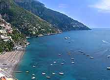
A popular town residing just to the south of central Italy, Positano is located next to the extremely beautiful Amalfi Coast, which is known in Italian as the Costiera Amalfitana. Positano enjoys a fairly sheltered setting, with its main cove featuring a backdrop of steep hills and cliffs, many of which are crammed with tiers of brightly coloured houses, almost like giant wedding cakes.
Very little space in Positano has been wasted and buildings are squeezed in everywhere possible, particularly if there is a coastal view to be taken advantage of. However, it does mean that there are a number of rather steep stairways dotted around the town, and some very winding roads, almost hugging the cliffs.
Maps and Orientation of the Town
There is no denying that this is an extremely pretty town. Many of the streets are so narrow that they are in reality more like corridors and alleyways, almost transporting you back in history to the time when Positano was a bustling fishing village.
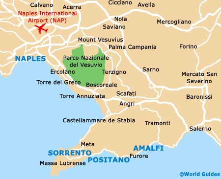
Positano itself is actually divided into two main areas, which are separated by the tall cliff supporting the towering Torre Trasita. Directly west you will find the relatively uncrowded beach of Spiaggia del Fornillo, while if you head to the east of this you will encounter the Spiaggia Grande. Maps of Positano are readily available at the tourist office, which resides at the base of the steps leading to the Chiesa di Santa Assunta.
- Amalfi - 16 km / 10 miles (20 minutes, east)
- Avellino - 79 km / 49 miles (one hour and 25 minutes, north-east)
- Caserta - 84 km / 52 miles (one hour and 35 minutes, north)
- Castellammare di Stabia - 26 km / 16 miles (32 minutes, north)
- Cava de Tirreni - 44 km / 27 miles (52 minutes, north-east)
- Eboli - 75 km / 47 miles (one hour and 25 minutes, east)
- Gragnano - 20 km / 12 miles (25 minutes, north)
- Massa Lubrense - 21 km / 13 miles (25 minutes, west)
- Naples (Napoli) - 60 km / 37 miles (one hour and 10 minutes, north-west)
- Nola - 70 km / 43 miles (one hour and 20 minutes, north)
- Pozzuoli - 83 km / 52 miles (one hour and 35 minutes, north-west)
- Praiano - 10 km / 6 miles (12 minutes, south-east)
- Ravello - 26 km / 16 miles (30 minutes, east)
- Salerno - 44 km / 27 miles (55 minutes, east)
- Sorrento - 16 km / 10 miles (15 minutes, west)
- Torre Annunziata - 37 km / 23 miles (42 minutes, north)
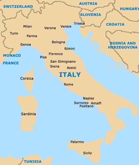
Map of Italy
Map of Positano