Killarney Maps and Orientation
(Killarney, County Kerry, Republic of Ireland)
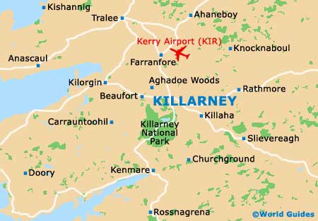
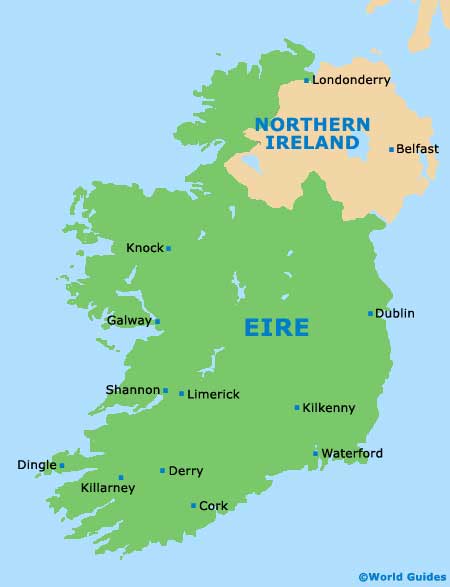
Killarney is situated in the middle of County Kerry in south-west
Ireland, around 300 km / 186 miles south-west of
Dublin and some 80 km / 50 miles west of Cork. It is bordered by only two other counties - County Limerick to the north-east and County Cork to the east.
Killarney is one of the gateway towns to the picturesque Iveragh Peninsula, as seen on the famed Ring of Kerry drive. It is also the main gateway to the stunning Killarney National Park, which lies just to the south and is accessed by way of the main south-heading Muckross Road.
Maps and Orientation of the Town
The town is laid out in true Irish style, with roads coming and going in all directions. That said, Killarney is served by two main highways - from
Cork via a bypass, and
Limerick. The Limerick road passes through the town and has shops, restaurants and hotels.
There is a ring road around the town with smaller roads and streets leading to the east and west, most of which can be negotiated on foot. For local maps, look to the Killarney Tourist Office on Beech Street, just west of the town centre.
- Cork - 86 km / 53 miles (one hour and 20 minutes, south-east)
- Dingle - 65 km / 40 miles (one hour and 15 minutes, west)
- Dublin - 300 km / 186 miles (three hours and 45 minutes, north-east)
- Galway - 210 km / 130 miles (three hours, north)
- Kenmare - 33 km / 20 miles (30 minutes, south)
- Kerry Airport - 17 km / 11 miles (20 minutes, north)
- Killarney National Park - 12 km / 7 miles (15 minutes, south)
- Limerick - 110 km / 68 miles (one hour and 45 minutes, north-east)
- Shannon - 130 km / 81 miles (two hours, north-east)
- Tralee - 33 km / 20 miles (30 minutes, north-west)
- Waterford - 190 km / 118 miles (three hours, east)
Map of the United Kingdom

Map of Ireland
Map of Killarney