Weston Super Mare Maps and Orientation
(Weston Super Mare, North Somerset, England, UK)
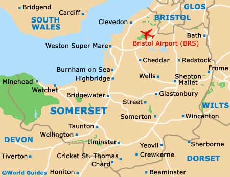
Located in the county of North Somerset, Weston Super Mare lies directly opposite
Cardiff, on the southern coast of
Wales, being separated by the Mouth of the Severn / Bristol Channel. A traditional seaside town with plenty of fun attractions, Weston Super Mare's coastal location is its main draw card and at low tide, the sea can be more than 1.5 km / 1 mile from the actual beachfront itself.
Maps and Orientation of the Town
Weston Super Mare is just a short distance from the A371 and the M5 motorway, linking
Bristol and the M4 to the north, which heads to Wales. To the south, the M5 connects
Exeter, close to Exmouth on the southern coast.
Prominent roads around the centre of Weston Super Mare include Devonshire Road, Drove Road, Winterstoke Road, Locking Road, Herluin Way (A370) and the Beach Road, which runs parallel to the seafront.
- Bath - 68 km / 42 miles (55 minutes, east)
- Bridgwater - 29 km / 18 miles (30 minutes, south)
- Bristol - 39 km / 24 miles (40 minutes, north-east)
- Burrington Combe - 16 km / 10 miles (25 minutes, west)
- Cheddar - 21 km / 13 miles (25 minutes, east)
- Clevedon - 19 km / 12 miles (22 minutes, north-east)
- Congresbury - 16 km / 10 miles (20 minutes, east)
- Failand - 34 km / 21 miles (30 minutes, north-east)
- Frome - 61 km / 38 miles (one hour and 10 minutes, west
- Nailsea - 26 km / 16 miles (25 minutes, north-east)
- Portishead - 34 km / 21 miles (30 minutes, north-east)
- Taunton - 48 km / 30 miles (45 minutes, south)
- Yatton - 18 km / 11 miles (25 minutes, east)
- Yeovil - 63 km / 39 miles (one hour and 5 minutes, south-east)
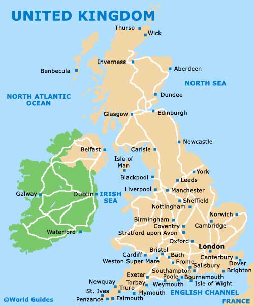
Map of the United Kingdom
Map of Somerset
Map of Weston Super Mare Area
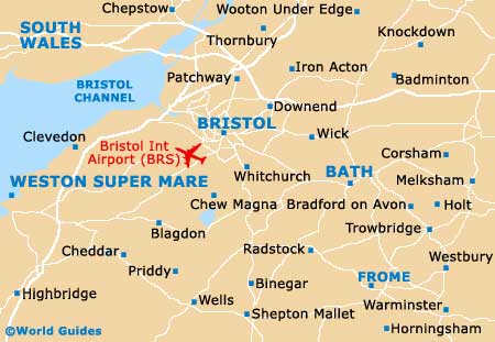
Map of Weston Super Mare

