Swanage Maps and Orientation
(Swanage, Dorset, England, UK)
A charming coastal town located in South-West
England, Swanage stands on the south-easterly shore of Dorset and on the eastern side of the Isle of Purbeck. Swanage is close to some of the region's finest beaches, such as those of
Bournemouth,
Boscombe, Sandbanks and Studland, amongst many others.
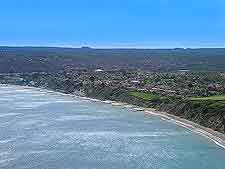
Swanage Bay faces to the east and serves as the main draw card here, being part of the world-famous Jurassic Coast. The bay itself is fronted by a sweeping expanse of sand, which appears almost endless and stretches right into the distance.
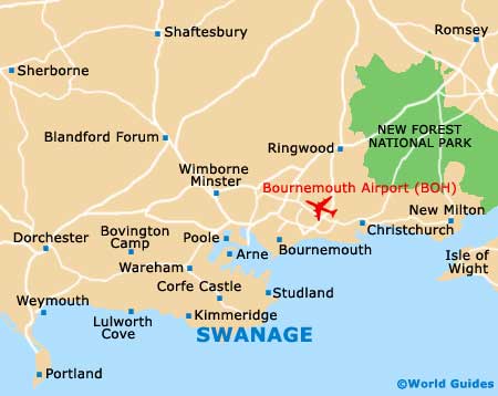
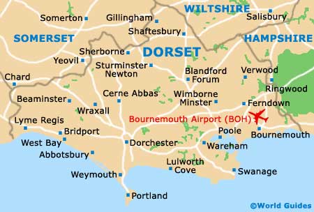
Maps and Orientation of the Town
Visitors requiring maps of the Dorset region with find that the Swanage Tourist Information Centre is located on the Shore Road and easy to find, since it is right by the beach itself. Various gift shops, eateries, local stores and amusements are close by, within the town centre. The following destinations are within driving distance of Swanage:
- Arne - 18 km / 11 miles (22 minutes, north-west)
- Blandford - 58 km / 36 miles (one hour and five minutes, north-east)
- Bognor Regis - 142 km / 89 miles (two hours and five minutes, east)
- Boscombe - 22 km / 14 miles (via ferry - 50 minutes, north-east)
- Bournemouth - 21 km / 13 miles (via ferry - 50 minutes, north-east)
- Brighton and Hove - 182 km / 114 miles (two hours and 50 minutes, east)
- Christchurch - 29 km / 18 miles (via ferry - one hour, north-east)
- Corfe Castle - 8 km / 5 miles (12 minutes, west)
- Creech - 16 km / 10 miles (20 minutes, north-west)
- Dorchester - 45 km / 28 miles (50 minutes, west)
- Ferndown - 40 km / 25 miles (45 minutes, north-east)
- Isle of Wight / Cowes - 99 km / 62 miles (via ferry - two hours and 20 minutes, east)
- Kimmeridge - 14 km / 9 miles (18 minutes, west)
- Kingston - 8 km / 5 miles (12 minutes, west)
- Langton Matravers - 3 km / 2 miles (five minutes, west)
- Lulworth - 29 km / 18 miles (35 minutes, west)
- Lyme Regis - 82 km / 51 miles (one hour and 30 minutes, west)
- Lymington - 64 km / 40 miles (one hour and 20 minutes, north-east)
- Lytchett Minster - 24 km / 15 miles (30 minutes, north-west)
- New Forest / Brockenhurst - 80 km / 50 miles (one hour and 20 minutes, north-east)
- New Milton - 64 km / 40 miles (one hour and 20 minutes, north-east)
- Plymouth - km / 127 miles (three hours, south-west)
- Poole - 30 km / 19 miles (35 minutes, north)
- Portsmouth - 114 km / 71 miles (one hour and 45 minutes, north-east)
- Salisbury - 72 km / 45 miles (one hour and 20 minutes, north)
- Southampton - 83 km / 52 miles (one hour and 30 minutes, north-east)
- Studland - 6 km / 4 miles (ten minutes, north)
- Torbay - 166 km / 104 miles (two hours and 30 minutes, south-west)
- Tyneham - 27 km / 17 miles (35 minutes, west)
- Wareham - 16 km / 10 miles (20 minutes, north-west)
- Weymouth - 45 km / 28 miles (55 minutes, west)
- Wimborne - 38 km / 24 miles (45 minutes, north)
- Worth Matravers - 16 km / 10 miles (20 minutes, north-west)
Map of the United Kingdom

Map of Dorset
Map of Swanage