Hartlepool Maps and Orientation
(Hartlepool, County Durham, England, UK)
Located in north-east
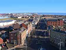
England, Hartlepool is a famous port town and lies on the northerly side of the Tees Valley, within County Durham and the actual Borough of Hartlepool. The town itself is just 30 minutes away from the city of Durham and stands alongside the coastline, where it is close to a selection of undeveloped beaches.
Founded as long ago as the 7th century, Hartlepool was historically a major centre for shipbuilding, although this industry rapidly declined following the Second World War. However, the fortunes of the town have certainly improved over the past two decades, following considerable investment and a significant redevelopment of the docks, with the arrival of a trendy marina area.
Maps and Orientation of the Town
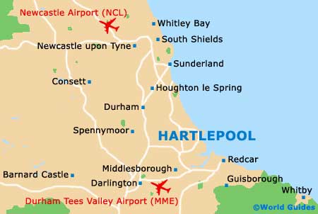
In central Hartlepool there are two main thoroughfares, the Belle Vue Way / Stranton / Stockton Street (A689) and the Mainsforth Terrace / Coronation Drive (A178), both of which head in a north to south direction. For maps of the town and County Durham, visit the Tourist Information Centre on Church Street, close to the railway station and Lynn Street.
The town centre is based around Jackson Dock and the Marina, while many of the main attractions lie at the end of the north-easterly Headland peninsula. On the westerly side of Hartlepool are the Throston Golf Course, the Park Drive Cricket Club and Summerhill. Directly to the south is the small seaside town of Seaton Carew, Seal Sands and the Teesmouth Field Centre.
- Billingham - 13 km / 8 miles (20 minutes, south)
- Bishop Auckland - 37 km / 23 miles (40 minutes, west)
- Cleveland - 45 km / 28 miles (45 minutes, south-east)
- Cornforth - 22 km / 14 miles (30 minutes, west)
- Darlington - 38 km / 24 miles (40 minutes, south-west)
- Durham - 29 km / 18 miles (30 minutes, north-west)
- Ferryhill - 29 km / 18 miles (35 minutes, west)
- Graythorp - 6 km / 4 miles (ten minutes, south)
- Guisborough - 40 km / 25 miles (40 minutes, south-east)
- Harrogate - 91 km / 57 miles (one hour and 25 minutes, south)
- Leeds - 120 km / 75 miles (one hour and 40 minutes, south)
- Middlesborough - 21 km / 13 miles (25 minutes, south)
- Newcastle upon Tyne - 51 km / 32 miles (50 minutes, north-west)
- Newton Aycliffe - 34 km / 21 miles (40 minutes, west)
- Peterlee - 13 km / 8 miles (20 minutes, north-west)
- Redcar - 40 km / 25 miles (40 minutes, south-east)
- Saltburn by the Sea - 45 km / 28 miles (45 minutes, south-east)
- Scarborough - 104 km / 65 miles (one hour and 40 minutes, south-east)
- Seaham - 27 km / 17 miles (30 minutes, north-west)
- Shildon - 37 km / 23 miles (40 minutes, west)
- Skelton - 46 km / 29 miles (45 minutes, south-east)
- Spennymoor - 29 km / 18 miles (35 minutes, west)
- Stockton on Tees - 19 km / 12 miles (25 minutes, south-west)
- Sunderland - 34 km / 21 miles (40 minutes, north-west)
- Thornaby on Tees - 13 km / 8 miles (20 minutes, south)
- Whitby - 72 km / 45 miles (one hour and 15 minutes, south-east)
- Wingate - 14 km / 9 miles (20 minutes, north-west)
- York - 94 km / 59 miles (one hour and 30 minutes, south)
Map of the United Kingdom

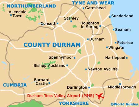
Map of County Durham
Map of Hartlepool