Odense Maps and Orientation
(Odense, Region Syddanmark, Denmark)
With around 180,000 people currently calling Odense their home, this city has become Denmark's third-largest city. Based on Funen Island, where it has become the proud capital, the city has grown up close to the Odense River, where boat trips often take place.
Odense is today linked to the neighbouring island of Zealand by the magnificent Great Belt Fixed Link Bridge, a famous Danish suspension bridge which has made the city extremely easy to reach and stretches for around 1.6 km / 1 mile. This bridge carries both cars and trains, and means that the Danish capital of
Copenhagen can now be reached in just over one hour by rail.
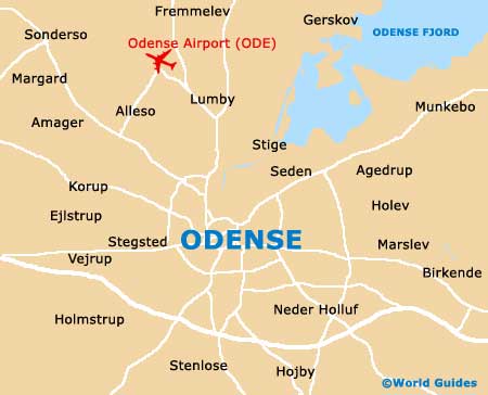
Maps and Orientation of the City
The tourist office (Odense Turistbureau) is situated within the Radhuset (Town Hall) and is a good place to pick up maps of the city. Maps are also available from bookshops along the Kongensgade and on the Vestergade.
The Odense tourist office is just a short walk from many of the main attractions, such as the cathedral (Sankt Knuds Kirke) on the Klosterbakken and the railway station (Odense Banegard), which lies directly north and contains a complex of shops and cafes.
- Aarhus - 146 km / 91 miles (one hour and 45 minutes, north)
- Copenhagen - 167 km / 104 miles (one hour and 50 minutes, east)
- Fredericia - 56 km / 35 miles (one hour, north-west)
- Haderslev - 102 km / 63 miles (one hour and ten minutes, west)
- Horsens - 107 km / 66 miles (one hour and 25 minutes, north)
- Kolding - 72 km / 45 miles (one hour and ten minutes, west)
- Langeland - 63 km / 39 miles (one hour, south)
- Lillebaelt - 121 km / 75 miles (one hour and 40 minutes, south)
- Naestved - 107 km / 66 miles (one hour and 25 minutes, east)
- Nyborg - 37 km / 23 miles (40 minutes, east)
- Randers - 176 km / 109 miles (two hours and ten minutes, north)
- Silkeborg - 142 km / 88 miles (one hour and 55 minutes, north)
- Slagelse - 75 km / 47 miles (one hour and ten minutes, east)
- Svendborg - 44 km / 27 miles (45 minutes, south)
- Vejle - 76 km / 47 miles (one hour and ten minutes, north-west)
Map of Denmark

Map of Odense