Brno Maps and Orientation
(Brno, South Moravia, Czech Republic)
A prominent city within the southerly Moravia area of the Czech Republic, Brno has a rich history of more than 1,000 years and a population of approximately 400,000 people. Brno is situated at the meeting point of both the Svratka River and the Svitava River, where it has become the regional capital and most important city.
Lying between the Southern Moravian Lowlands and also the Bohemian Moravian Highlands, the Czech city of Brno may not be as flashy as
Prague, but it does have plenty to offer. As you arrive in the city centre, you will find this part of Brno is very much dominated by Spilberk Castle, which stands proudly atop a hill of the same name.
Maps and Orientation of the City
Another notable landmark and extremely useful point of reference in Brno is the Cathedral of SS Peter and Paul, which is close to Spilberk Castle and to be found on the neighbouring Petrov Hill. The main railway station in Brno is to be found on the southern side of the city and directly opposite the traffic-free thoroughfare that is the Masarykova, which heads in a northerly direction to the Námesti Svobody.
The bus station in Brno is close by and just a stone's throw from the railway station and also near to the Galerie Vankovka shopping centre. Those wishing to purchase maps of Brno should look no further than the bookshops along the Vachova and the Námesti Svobody, and the Tourist Information Centre, on the Radnická. A further tourist office selling maps and guides of Brno stands opposite to the railway station, on the Nádrazvni.
- Blansko - 31 km / 19 miles (35 minutes, north)
- Boskovice - 42 km / 26 miles (50 minutes, north)
- Bratislava - 132 km / 82 miles (two hours, south)
- Ivancice - 29 km / 18 miles (30 minutes, south-west)
- Kurim - 16 km / 10 miles (22 minutes, north)
- Letovice - 43 km / 27 miles (50 minutes, north)
- Litovel - 99 km / 62 miles (one hour and 30 minutes, north-east)
- Mohelnice - 113 km / 70 miles (one hour and 45 minutes, north-east)
- Olomouc - 83 km / 52 miles (one hour and 15 minutes, north-east)
- Ostrava - 181 km / 112 miles (two hours and 25 minutes, north-east)
- Prague (Praha) - 205 km / 127 miles (two hours and 40 minutes, north-west)
- Prerov - 84 km / 52 miles (one hour and 15 minutes, north-east)
- Prostejov - 65 km / 40 miles (one hour and five minutes, north-east)
- Telc - 98 km / 61 miles (one hour and 35 minutes, west)
- Velka Bites - 38 km / 24 miles (45 minutes, west)
- Vienna (Wien) - 126 km / 78 miles (two hours, south)
- Vyskov - 39 km / 24 miles (45 minutes, east)
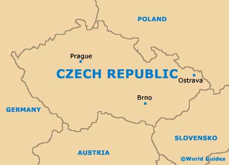
Map of the Czech Republic
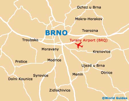
Map of Brno