Zagreb Maps and Orientation
(Zagreb, Croatia)
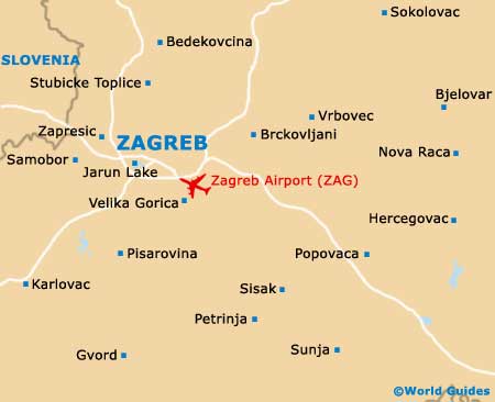
Zagreb lies up in the north of the country, at the western end of Eastern Europe. It is fairly remote with regard to most of Europe and is easily Croatia's biggest city. Zagreb is divided up into two main areas on maps - the Upper (old) Town and the Lower (newer) Town. Each has separate districts, such as Kaptol and Gradec in the Upper Town.
Most tourists choose to stay in the Lower Town, as it has more (and cheaper) hotels and contains the bulk of the shopping and eating opportunities. The business end of the city is in the Upper Town, which is the original, medieval core of Zagreb. This area is known as the 'Upper' due to its loftier setting. It is worth obtaining city maps, since there are many nooks and crannies in the layout.
Maps and Orientation of the City
If you have good Zagreb maps and clue yourself up on Croatian signage, you can easily get about the city on foot, while extensive bus and tram lines connect most places of interest. In addition, those renting cars should absolutely have maps of the area, as country routes go off in all directions, leading to medieval towns and villages.
Zagreb maps can be ordered online before travelling, plus you can also pick up maps at the Tourist Information Centres on the Trg Jospipa Jelacica and the Trg Nikole Subica Zrinskog. These outlets are open all week and provide brochures, books and souvenirs on both the city and country as a whole. In addition, most mid-range hotels upwards will be able to furnish you with maps of Zagreb, and usually for free.
- Bedekovcina - 55 km / 34 miles (one hour, north)
- Brckovljani - 28 km / 17 miles (40 minutes, east)
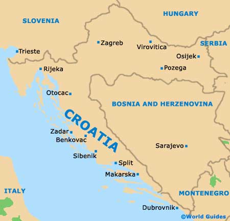
- Dalmatia (Ruzic) - 367 km / 228 miles (three hours and 45 minutes, south)
- Dubrovnik - 632 km / 395 miles (seven hours and 30 minutes, south)
- Jarun Lake - 8 km / 5 miles (15 minutes, south-west)
- Karlovac - 55 km / 34 miles (one hour, south-west)
- Lepoglava - 74 km / 46 miles (one hour and 15 minutes, north)
- Pula - 267 km / 166 miles (three hours and 25 minutes, south-west)
- Rijeka - 161 km / 100 miles (two hours, south-west)
- Samobor - 25 km / 16 miles (35 minutes, west)
- Sisak - 84 km / 52 miles (one hour and 25 minutes, south-east)
- Split - 408 km / 254 miles (four hours, south)
- Sveta Nedjelja - 21 km / 13 miles (35 minutes, west)
- Velika Gorica - 18 km / 11 miles (30 minutes, south)
- Vrbovec - 45 km / 28 miles (45 minutes, east)
- Zadar - 285 km / 177 miles (three hours, south-west)
- Zapresic - 19 km / 12 miles (30 minutes, west)
Map of Croatia
Map of Zagreb