Xian Maps and Orientation
(Xian, Shaanxi, China)

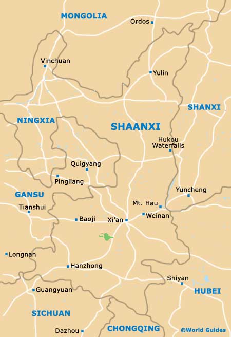
The city of Xian resides within the Chinese province of Shaanxi and enjoys a fairly central location within the People's Republic of
China, being close to Lanzhou. Xian has a population of more than two and a half million people and is a particularly ancient part of China, being known to date back more than 6,000 years.
Rather rectangular in its overall shape, Xian is comprised of straight avenues and streets, which intersect and form a gridwork structure. The very centre of the modern day city is surrounded by city walls and is based around the imposing Bell Tower.
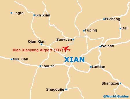
Maps and Orientation of the City
Surrounding the city's very famous Bell Tower are four important streets, named the Bei, the Dong, the Nan and the Xi Dajie. Directly to the north-west is the railway station, which can be reached along the Jiefang Lu, which is connected to the Dong Dajie.
The majority of the tourist facilities in Xian tend to be situated along the Jiefang Lu, or alternatively, on the Dong Dajie or the Xi Dajie. Maps of the city area are available at the Xian Tourist Information Services Centre on the Jiefang Lu, opposite the train station. However, the main places of interest are usually located outside of this central district.
- Ankang - south
- Beijing - north-east
- Chengdu - south-west
- Fengxian - west
- Hua Shan - east
- Kaifeng - east
- Lanzhou - north-west
- Pucheng - north-east
- Qingdao - north-east
- Shangzhou - south-east
- Taiyuan - north-east
- Tongchuan - north
- Wuhan - south-east
- Xianyang - west
- Zhenan - south
- Zhengzhou - east
Map of China
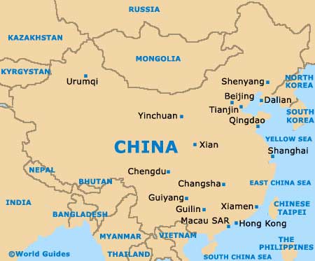
Map of China
Map of Xian