El Alamein Maps and Orientation
(El Alamein, Egypt)
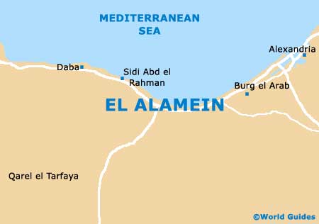
A famous village on the coastline of northern Egypt, El Alamein is bordered by the Mediterranean Sea. El Alamein is within reach of two particularly famous Egyptian cities, both
Alexandria and
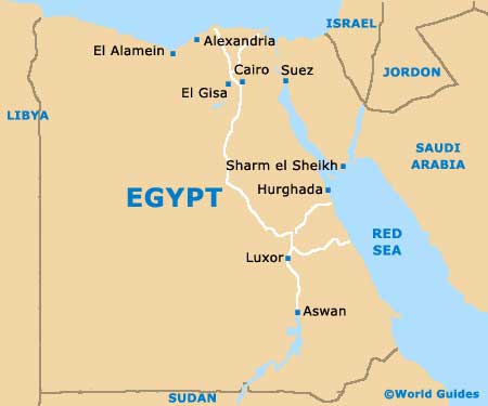
Cairo. Alexandria lies around 105 km / 65 miles to the east of El Alamein, while Cairo is just over 240 km / 149 miles to the south-east and is home of the world-famous Giza pyramids.
Maps and Orientation of the City
Close to El Alamein, Sidi Abdel Rahman is a notable coastal resort and can be found around 23 km / 14 miles to the west. Home to a stunning stretch of white sandy beachfront, Sidi Abdel Rahman is a particularly appealing area of natural beauty and is by no means over developed. Also nearby is the attractive town of Marsa Matruh, which is centred around a large bay and boasts a number of popular beaches. A favourite excursion for those visiting El Alamein, Marsa Matruh becomes extremely busy during the summer, when many locals head to the seafront.
Further west and heading towards Libya you will find the small town of Sidi Barani, a busy spot known for its Bedouin character. Nearby and located at the very base of the Gebel as-Sallum, the town of Sallum remains fairly undiscovered by European tourists and was once a thriving Roman port many years ago. Here are the most interesting cities, towns and villages, which are reasonably close to El Alamein.
- Abu Haggag
- Abu Qir
- Alexandria
- Cairo
- Burg el Arab
- Daba
- Garawla
- Ghazal
- Hammam
- Marsa Matruh
- Ras el Hekma
- Sidi Abdel Rahman
- Sidi Matwas
- Zawia Ashtuh
- Zawia Etnooh
- Zawyet el Sinusiya
Continent Map of Africa

Map of Egypt
Regional Map Map of El Alamein