Jackson Hole Maps and Orientation
(Jackson Hole, Wyoming - WY, USA)
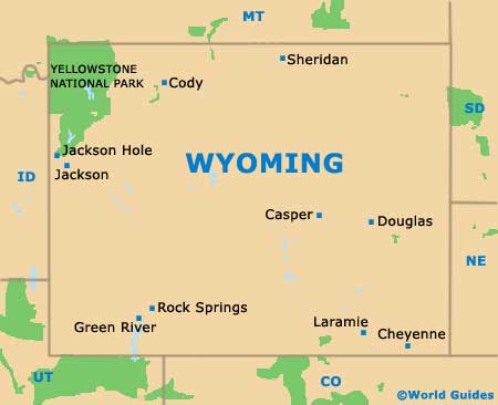
Lying within Teton County and is the American state of Wyoming, the Jackson Hole area enjoys a rather scenic valley setting. The western side of the Jackson Hole valley boasts a rather magnificent mountains backdrop, with the snowcapped peaks of the neighboring Teton Range providing quite a contrast to the surround rolling meadowland. To the east, the Gros Ventre wilderness dominates the area.
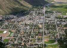
Jackson Hole is located on the northwestern side of Wyoming and is home to the town of Jackson, which may have a population of less than 10,000 residents, but is visited each year by literally millions of tourists, on their way to the National Elk Refuge, the
Grand Teton National Park, and of course, the simply vast
Yellowstone National Park, which is sited directly north and dominates the region. Various winter ski resorts are also close by, adding further to the tourist appeal in the snowy winter months.
Maps and Orientation of the Area
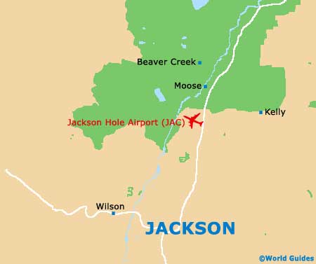
The name Jackson Hole refers to the entire valley region, with the world 'Hole' being adding many years ago, when explorers first came upon this deep valley. Maps are essential if you are planning to fully explore the area by car, being available at the Jackson Hole Visitors Center, the USFS Bridger Teton National Forest Headquarters, and also at the Valley Bookstore, all of which are to be found on the North Cache Drive.
The following destinations are shown in relation to Jackson town:
- Alpine - 42 miles / 68 km (55 minutes, south)
- Bondurant - 35 miles / 56 km (50 minutes, southeast)
- Grand Teton National Park - 20 miles / 32 km (30 minutes, north)
- Hoback - 18 miles / 29 km (30 minutes, south)
- Kelly - 14 miles / 23 km (22 minutes, northeast)
- Moose - 13 miles / 21 km (20 minutes, north)
- Palisades Reservoir (Idaho) - 43 miles / 69 km (55 minutes, southwest)
- Rafter J. Ranch - 7 miles / 11 km (18 minutes, south)
- Teton Village - 13 miles / 21 km (22 minutes, northwest)
- Tetonia - 41 miles / 66 km (one hour and five minutes, northwest)
- Victor (Idaho) - 24 miles / 39 km (35 minutes, west)
- West Yellowstone - 126 miles / 203 km (three hours, north)
- Wilson - 7 miles / 11 km (12 minutes, west)
- Yellowstone Lake - 99 miles / 159 km (two hours and five minutes, north)
- Yellowstone National Park - 95 miles / 153 km (two hours and 15 minutes, north)
Map of the United States

Map of Wyoming
Map of Jackson Hole