Cheyenne Maps and Orientation
(Cheyenne, Wyoming - WY, USA)
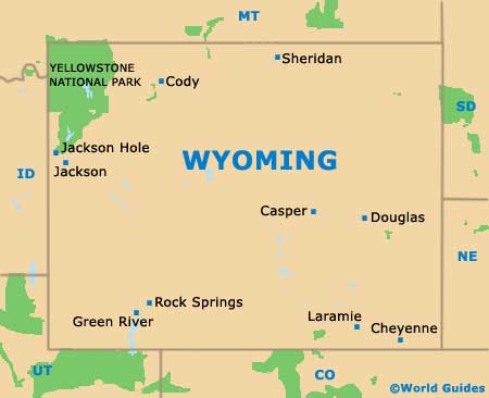
The state of Wyoming is located on the northwestern side of North America, close to the border with Colorado and a relatively short distance from
Nebraska. Cheyenne is actually one of America's least central state capitals.
Cheyenne serves as both the capital of Wyoming and as the state's biggest city, as well as also being the county seat for Laramie County and part of the Front Range Urban Corridor. The city's population has now exceeded 60,000, while the metropolitan area is home to approximately 100,000 residents.
The city of Cheyenne gradually grew up around the Dry Creek and Crow Creek in the latter half of the 19th century. Today, the capital is divided into a series of neighborhoods and significant suburbs, including those of Alta Vista, Antelope Hills, Capitol Heights, Monterey Heights, Mustang Ridge, Orchard Valley, Sun Valley and Western Hills.
Maps and Orientation of the City
Maps will certainly help you navigate your way around the downtown district. The majority of downtown Cheyenne is made up of square blocks with intersecting named avenues (roughly northwest to southeast) and numbered streets (roughly northeast to southwest).
When using a map of Cheyenne, look out for prominent landmarks, such as St. Mary's Cathedral, the Historic Governor's Mansion, the Wyoming State Library, the Wyoming State Museum and the Civic Center. All of these are useful points of reference, being located in the city center and radiating outwards from the Wyoming State Capitol Building. Further afield is the Lakeview Cemetery (northeast), the Jerry Olson Field Airport (north), Lake Minnehaha and Holliday Park (east) and the spreading Francis E. Warren Air Force Base (west).
- Boulder, Colorado (CO) - south
- Golden Gate Canyon State Park, Colorado (CO) - south
- Centennial, Colorado (CO) - south
- Curt Gowdy State Park - west
- Denver, Colorado (CO) - south
- Evans, Colorado (CO) - southwest
- Fort Collins, Colorado (CO) - south
- Fort Morgan, Colorado (CO) - southeast
- Greeley, Colorado (CO) - southeast
- Idaho Springs, Colorado (CO) - south
- Laramie - west
- Lory State Park, Colorado (CO) - south
- Loveland, Colorado (CO) - south
- Pawnee National Grassland, Colorado (CO) - southeast
- Jackson Lake State Park, Colorado (CO) - southeast
- Windsor, Colorado (CO) - south
Map of USA
Map of Wyoming
Map of Cheyenne
