Raleigh Maps and Orientation
(Raleigh, North Carolina - NC, USA)
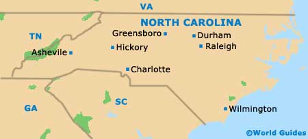
The center of North Carolina is where you will find the Piedmont region. It is here where the three cities of Chapel Hill, Durham and Raleigh come together to form the 'Triangle', together with their respective universities.
Chapel Hill is home to the University of North Carolina (UNC) and Durham is where you will find the Duke University, while the North Carolina State University (NCSU) is located in Raleigh.
Although Raleigh is actually the second-biggest city in North Carolina, after Charlotte, it serves as the state capital. The city is also the county seat (administrative center) for Wake County and sits just outside the top 40 biggest cities in the USA.
Maps and Orientation of the City
Lying to the northwest, both Chapel Hill and Durham are connected by Interstate I-40 (Dan K. Moore Freeway). The I-40 also heads southwards to Benson, Warsaw, Murraysville and Wilmington, with this stretch being named as both the Tom Bradshaw Freeway and the James E. Harrington Freeway.
Maps of the city and state can be sourced at the centrally located Greater Raleigh Convention and Visitors Bureau, which stands on Fayetteville Street, close to the Pope House Museum and the Lincoln Theater. Just a few blocks away and to the west, the Raleigh Amphitheater and Festival Site has become a major entertainment and performing arts venue, since its opening in the summer of 2010.
- Apex - 14 miles / 23 km (25 minutes, west)
- Cary - 11 miles / 18 km (20 minutes, west)
- Chapel Hill - 32 miles / 51 km (50 minutes, northwest)
- Clayton - 16 miles / 26 km (25 minutes, southeast)
- Durham - 28 miles / 45 km (40 minutes, northwest)
- Franklinton - 27 miles / 43 km (40 minutes, northeast)
- Fuquay Varina - 17 miles / 27 km (30 minutes, south)
- Garner - 6 miles / 10 km (12 minutes, south)
- Holly Springs - 18 miles / 29 km (30 minutes, southwest)
- Jordon Lake State Recreation Area - 24 miles / 39 km (35 minutes, southwest)
- Knightdale - 14 miles / 23 km (25 minutes, east)
- Morrisville - 17 miles / 27 km (30 minutes, west)
- Pittsboro - 33 miles / 53 km (50 minutes, west)
- Raven Rock State Park - 40 miles / 64 km (one hour, south)
- Thomas E. Brooks Park - 20 miles / 32 km (30 minutes, west)
- Wake Forest - 18 miles / 29 km (30 minutes, northeast)
- Wendell - 21 miles / 34 km (35 minutes, east)
- William B. Umstead State Park - 14 miles / 23 km (25 minutes, northwest)
- Zebulon - 23 miles / 37 km (35 minutes, east)
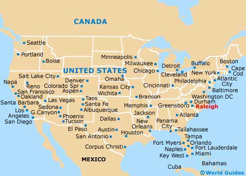
Map of the United States
Map of North Carolina
Map of Raleigh

