San Jose Maps and Orientation
(San Jose, California - CA, USA)
Lying on the western side of California, close to the Pacific coastline and part-way between
Oakland and
Monterey, the sizeable city of San Jose belongs to the county of Santa Clara, where it is the proud capital city.
The biggest city within California's famous Silicon Valley region, San Jose is a part of the Greater San Francisco Bay Area and lies just over an hour away from the iconic Golden Gate Bridge.
Over the years, San Jose has suffered minimal earthquake damage, with rarely more than two moderate quakes most years. This seismic activity is the result of its location nearby both the San Andreas Fault and the Calaveras Fault, with activity being generally centered on the eastern side of the city. The Loma Prieta earthquake of 1989 is the last significant earthquake to hit the San Francisco Bay Area.
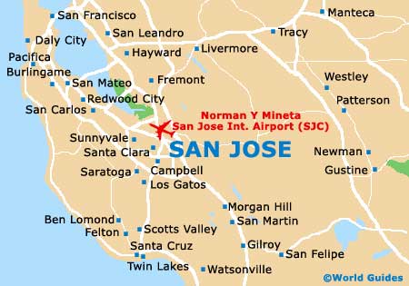
Maps and Orientation of the City
The Guadalupe River has shaped much of the city's main layout, which originates from the Santa Cruz Mountains and runs northwards, through downtown San Jose. Tourists may like to consider a stroll along the scenic Guadalupe River Trail, which connects the Guadalupe River Park with West Santa Clara Street.
Those self-driving with maps will find that notable highways include the Sinclair Freeway (Interstate I-280), the Bayshore Freeway (US-101), the Nimitz Freeway (Interstate I-880) and the Guadalupe Parkway (SR-87).
- Big Sur - 100 miles / 161 km (one hour and 50 minutes, south)
- Carmel by the Sea - 75 miles / 121 km (one hour and 25 minutes, south)
- Cupertino - 10 miles / 16 km (15 minutes, west)
- Fremont - 17 miles / 27 km (30 minutes, north)
- Hayward - 27 miles / 43 km (40 minutes, north)
- Lexington Hills - 18 miles / 29 km (30 minutes, south)
- Los Gatos - 12 miles / 19 km (20 minutes, south)
- Milpitas - 7 miles / 11 km (12 minutes, north)
- Monterey - 70 miles / 113 km (one hour and 35 minutes, south)
- Morgan Hill - 23 miles / 37 km (40 minutes, southeast)
- Napa Valley - 82 miles / 132 km (one hour and 40 minutes, north)
- Oakland - 41 miles / 66 km (one hour, northwest)
- Sacramento - 118 miles / 190 km (two hours and 40 minutes, north)
- San Francisco - 48 miles / 77 km (one hour and 15 minutes, northwest)
- Santa Clara - 5 miles / 8 km (ten minutes, west)
- Santa Cruz - 32 miles / 51 km (50 minutes, southwest)
- Saratoga - 13 miles / 21 km (20 minutes, southwest)
- Sunnyvale - 12 miles / 19 km (20 minutes, west)
- Watsonville - 47 miles / 76 km (one hour and ten minutes, south)
Map of the United States

Map of California

Map of San Jose