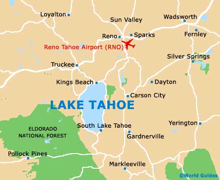
Lake Tahoe Maps and Orientation
(Lake Tahoe, California - CA, USA)
A beautiful and tranquil spot, surrounded by endless vacation opportunities and rugged mountain peaks, Lake Tahoe lies on the very end of the Californian border and is just a stone's throw from
Nevada. Directly north are Nevada's well-known cities of Reno and Sparks, both of which are relatively close to Lake Tahoe and lie within Washoe County.
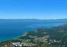
Lake Tahoe is actually the biggest Alpine lake in the whole of the USA and one of the deepest, being well known for its extremely clarity and beauty. Tahoe City lies on the lake's northwesterly shore, between Carnelian Bay and Homewood, and is the region's largest town, while to the northeast and along Highway 28, both the Kings Beach and Tahoe Vista can be found. The Lake Tahoe Nevada State Park is close by and is always extremely popular with lovers of the 'great outdoors'.
Maps and Orientation of the Region
The historical mining town of Truckee resides on the northwestern side of Lake Tahoe, where it is brimming with shops and restaurants, and stands alongside the Donner Lake. On the southerly shores, South Lake Tahoe is situated, being close to the border between both Nevada and California.
Maps of the region are available at a number of visitors centers in the largest towns around the lake's shore and are essential, should you be planning a self-navigated tour of the area's main resorts and attractions.
- Carson City (Nevada) - east
- Chico - northwest
- Fernley (Nevada) - northeast
- Gardenerville (Nevada) - east
- Lahontan State Recreational Area (Nevada) - northeast
- Meadow Vista - west
- Minden (Nevada) - east
- Napa Valley - southwest
- Oakland - southwest
- Reno (Nevada) - northeast
- Roseville - southwest
- Sacramento - southwest
- San Francisco - southwest
- Silver Springs (Nevada) - northeast
- Sparks (Nevada) - northeast
- Sun Valley (Nevada) - northeast
- Truckee - northwest
- Yosemite National Park - south
Map of the United States

Map of California

Map of Lake Tahoe