Tucson Maps and Orientation
(Tucson, Arizona - AZ, USA)
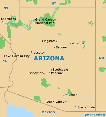
Set within the Sonoran Desert, the city of Tucson is to be found on the southeastern side of the state of Arizona, close to Green Valley and within Pima County, where it is the county seat.
Many suburbs surround Tucson, such as Casas Adobes, Drexel Heights, Sahuarita and Vail. The Catalina Foothills, the Oro Valley and the Santa Catalina Natural Area all lie to the north, while the Saguaro National Park resides to the east, and the Coronado National Forest to the south.
Interstate I-10 dissects the city of Tucson and heads in a northwest to southeast direction, connecting Chandler, Glendale,
Mesa,
Phoenix and
Scottsdale to the northwest. The Sonoran Desert National Monument is also to be found in this direction, along the I-8 turn-off. The Mexican border is roughly a 90-minute drive to the south, being reached via the I-19, which links the twin border cities of Nogales (Santa Cruz County) and Nogales (Sonora,
Mexico).
Maps and Orientation of the City
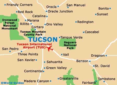
Downtown Tucson is where much of the interest awaits, with its historic district situated to the east of exit 258 on the I-10. To the north of the downtown district is the spreading campus of the University of Arizona, along with the plentiful shops and eateries lining the prominent thoroughfare of 4th Avenue.
For maps of the city, the Tucson Convention and Visitors Center is the place to go, being located on the western side, along South Church Avenue. Notable landmarks close to the Visitors Center include the St. Augustine Cathedral, the Unisource Energy Tower and the Fox Theater.
- Casas Adobes - 11 miles / 18 km (20 minutes, northwest)
- Catalina Foothills - 8 miles / 13 km (15 minutes, north)
- Corona De Tucson - 24 miles / 39 km (40 minutes, southeast)
- Drexel Alvernon - 7 miles / 11 km (15 minutes, south)
- Drexel Heights - 11 miles / 18 km (20 minutes, southwest)
- Flowing Wells - 10 miles / 16 km (20 minutes, northwest)
- Green Valley - 29 miles / 47 km (50 minutes, south)
- Littletown - 9 miles / 14 km (15 minutes, south)
- Marana - 27 miles / 43 km (45 minutes, northwest)
- Oro Valley - 15 miles / 24 km (25 minutes, north)
- Sahuarita - 23 miles / 37 km (40 minutes, south)
- Santa Catalina Natural Area - 39 miles / 63 km (one hour and 15 minutes, northeast)
- Summit - 13 miles / 21 km (22 minutes, south)
- Tanque Verde - 13 miles / 21 km (22 minutes, east)
- Tortolita - 18 miles / 29 km (30 minutes, northwest)
- Valencia West - 15 miles / 24 km (25 minutes, southwest)
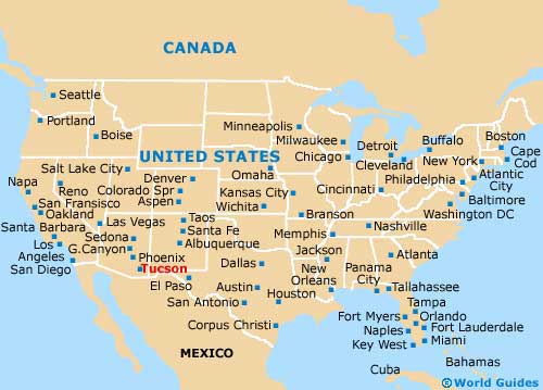
Map of the United States
Map of Arizona
Map of Tucson