Birmingham Maps and Orientation
(Birmingham, Alabama - AL, USA)
Situated on the northern side of central Alabama, the city of Birmingham resides within Jefferson County, where it is the county seat and biggest city. However, part of the city does also reside within Shelby County.
The city belongs to the Birmingham-Hoover Metropolitan Area, which is also often referred to as simply Greater Birmingham and comprises seven different counties, namely Bibb, Blount, Chilton, Jefferson, St. Clair, Shelby and Walker. The most sizeable cities based within this metro area include those of Alabaster, Bessemer, Center Point, Helena, Homewood, Hoover, Hueytown, Moody, Mountain Brook, Pelham and Trussville.
Also based within Greater Birmingham is the Cahaba River National Wildlife Refuge, the Oak Mountain State Park and the Talladega National Forest.
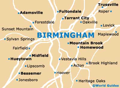
Maps and Orientation of the City
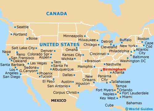
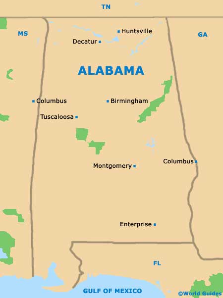
Various interstates radiate outwards from central Birmingham, such as the I-65 (north), the I-59 (northeast), the I-20 (east / southwest), the I-65 (south), and the I-22 (northwest). Therefore, those with a rental car and map will find that exploring Alabama's other cities is relatively simple. The I-20 connects the city of Tuscaloosa, while the I-65 heads to
Montgomery.
Those prepared for a drive can simply follow the I-20 eastwards all the way to
Atlanta, with this state capital of
Georgia being roughly 145 miles / 233 km away.
Tourists will find that the city's principal attractions are located in downtown Birmingham, being particularly concentrated around the Fourth Avenue Historic District. 20th Street is a notable thoroughfare lined with shops, eateries and lively nightspots.
- Adamsville - 13 miles / 21 km (25 minutes, northwest)
- Bessemer - 16 miles / 26 km (30 minutes, southwest)
- Chattanooga - 145 miles / 233 km (three hours and 25 minutes, northeast)
- Decatur - 81 miles / 130 km (one hour and 45 minutes, north)
- Enterprise - 177 miles / 285 km (four hours, south)
- Gardendale - 13 miles / 21 km (25 minutes, north)
- Homewood - 5 miles / 8 km (ten minutes, south)
- Hoover - 10 miles / 16 km (25 minutes, south)
- Huntsville - 102 miles / 164 km (two hours and ten minutes, north)
- Montgomery - 92 miles / 148 km (two hours, south)
- Mountain Brook - 5 miles / 8 km (ten minutes, southeast)
- Pleasant Grove - 11 miles / 18 km (25 minutes, west)
- Sylvan Springs - 15 miles / 24 km (30 minutes, west)
- Tuscaloosa - 59 miles / 95 km (one hour and 15 minutes, southwest)
- Vestavia Hills - 6 miles / 10 km (ten minutes, south)
Map of the United States
Map of Alabama
Map of Birmingham