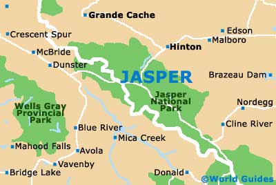
Jasper Maps and Orientation
(Jasper, Alberta - AB, Canada)
The Jasper townsite has much more of an intimate vibe than nearby
Banff and almost feels a little like an original frontier town. Located on the western side of Canada's province of Alberta, Jasper marks the commercial heart of the much-visited Jasper National Park and lies within the Canadian Rocky Mountains.
Jasper is actually to be found in the very scenic Athabasca River Valley and next to the Miette River. Prominent nearby mountains include both the Maligne Range and the Pyramid Mountain. Also close by is the Patricia Lake, the Pyramid Lake and Lake Annette.
Maps and Orientation of the City
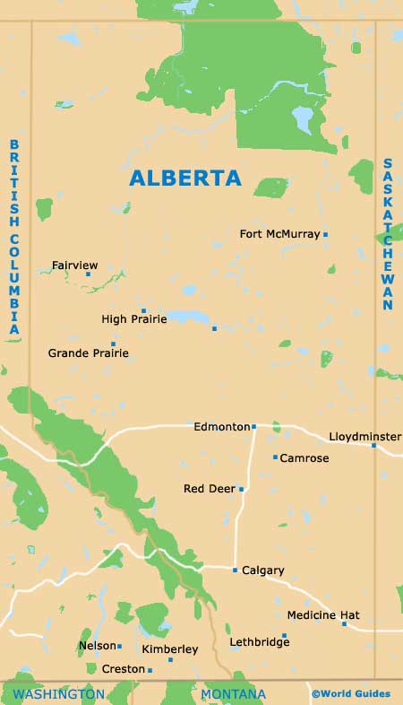
Day trippers looking to venture outside of Jasper will likely find themselves on the Yellowhead Highway, or headed towards the Banff National Park and on the Icefield Parkway. The town of Banff is relatively nearby and lies around 180 miles / 290 km to the south, while
Edmonton is a little further away, being some 225 miles / 360 km to the east.
Map of Canada

Map of Alberta
Map of Jasper