Foz do Iguacu Maps and Orientation
(Foz do Iguacu, Paraná, Brazil)
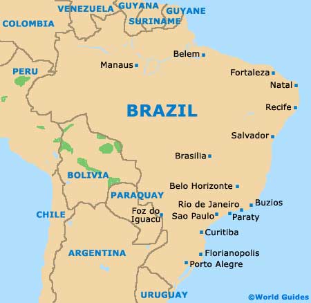
Located in the state of Paraná, where it is the fourth-biggest city, Foz do Iguacu lies in the southern region of
Brazil, close to the Iguacu Falls. Foz do Iguacu stands roughly 650 km / 400 miles to the west of the state capital
Curitiba, being linked to the east by the Friendship Bridge and the BR-277.
Just a short distance from the borders to
Argentina and Paraguay, Foz do Iguacu now has a population of more than 300,000 residents, which include significant Chinese and Islamic communities. Along with the neighbouring cities of Puerto Iguazu in Argentina and Ciudad del Este in Paraguay, this part of South America has become something of a tourist hotspot.
Maps and Orientation of the City
The Avenida Brasil forms the principal thoroughfare in the city, heading in a north to south direction and connecting many points of interest. Just under 5 km / 3 miles to the north-east of central Foz do Iguacu and near to the Avenida Republica Argentina is the city's bus station, which serves both the local airport and also the Parque Nacional do Iguacu.
Maps of Foz do Iguacu are available at both the bus station and the airport. Located on the Praca Getulio Vargas, the tourist office is another good place for local maps and opens each day between 07:00 and 23:00.
- Caaguazu - 157 km / 98 miles (two hours and 45 minutes, west)
- Capanema - 108 km / 67 miles (two hours, east)
- Capitao Leonidas Marques - 155 km / 96 miles (two hours and 30 minutes, east)
- Cascavel - 145 km / 90 miles (two hours and 30 minutes, north-east)
- Cedrales - 23 km / 14 miles (40 minutes, south-west)
- Ciudad del Este - 17 km / 11 miles (25 minutes, west)
- Eldorado - 109 km / 68 miles (two hours, south)
- Hernandarias - 25 km / 16 miles (40 minutes, north)
- Marechal Candido Rondon - 176 km / 109 miles (three hours, north)
- Medianeira - 59 km / 37 miles (one hour and 15 minutes, north-east)
- Puerto Iguazu - 7 km / 4 miles (12 minutes, south)
- Santa Helena - 105 km / 65 miles (two hours, north)
- Santa Rita - 79 km / 49 miles (one hour and 30 minutes, south-west)
- Santa Terezinha de Itaipu - 24 km / 15 miles (40 minutes, east)
- Sao Miguel do Iguacu - 45 km / 28 miles (one hour, north-east)
- Toledo - 159 km / 99 miles (two hours and 35 minutes, north-east)
Map of Brazil
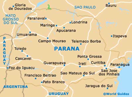
Map of Parana
Map of Foz do Iguacu

