Belo Horizonte Maps and Orientation
(Belo Horizonte, Minas Gerais, Brazil)
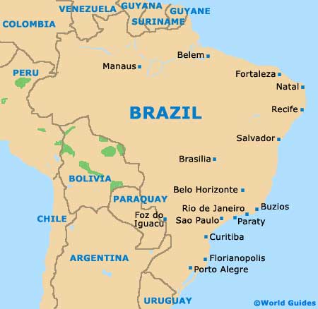
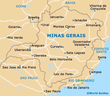
Located in the state of Minas Gerais, where it is the capital city, Belo Horizonte lies on the south-easterly side of Brazil.
Often referred to as simply 'BH', Belo Horizonte was established in the early part of the 18th century, although it was not until the end of the 19th century that the city of today was planned and built. Many historic buildings stand close to modern skyscrapers in the city, while the surrounding mountains provide a particularly beautiful backdrop.
Metropolitan Belo Horizonte (Greater BH) has grown to become the third-biggest region in the whole of
Brazil and contains an overall population fast approaching six million people, being made up of some 34 different municipalities.
Maps and Orientation of the City
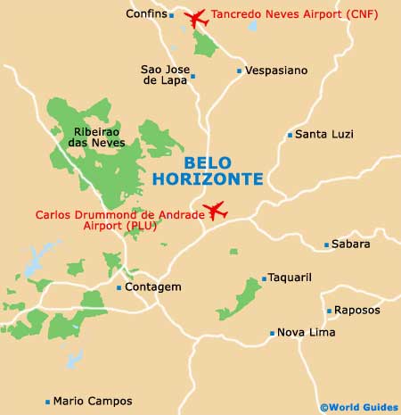
The city of Belo Horizonte has been constructed on a number of hills, with some of the best views being available from the Parque das Mangabeiras, within the outlying Serra do Curral hills. A gridwork of prominent avenues make up the centre of Belo Horizonte, with the original city boundaries being formed by the Avenida do Contorno.
The Avenida Afonso Pena forms the main thoroughfare and heads in a north-west to south-east direction, passing the Parque Municipal along the way. Nearby are the prominent public squares named the Praca Sete, the Praca da Liberdade and the Praca da Savassi.
Of note, Belo Horizonte maps are often a little misleading, since this is a hilly city and therefore getting around isn't always as straightforward as it seems.
- Betim - 43 km / 27 miles (50 minutes, south-west)
- Brumadinho - 64 km / 40 miles (one hour and 20 minutes, south-west)
- Congonhas - 90 km / 56 miles (one hour and 30 minutes, south)
- Contagem - 30 km / 19 miles (35 minutes, south-west)
- Ibirité - 33 km / 21 miles (40 minutes, south-west)
- Lagoa Santa - 27 km / 17 miles (35 minutes, north)
- Mario Campos - 58 km / 36 miles (one hour and 15 minutes, south-west)
- Matozinhos - 35 km / 22 miles (40 minutes, north-west)
- Nova Lima - 49 km / 30 miles (one hour, south)
- Ouro Preto - 110 km / 68 miles (one hour and 40 minutes, south-east)
- Pedro Leopoldo - 29 km / 18 miles (25 minutes, north)
- Raposos - 55 km / 34 miles (one hour and ten minutes, south-east)
- Ribeirao das Neves - 18 km / 11 miles (25 minutes, west)
- Sabara - 30 km / 19 miles (40 minutes, south-east)
- Santa Luzia - 17 km / 11 miles (25 minutes, north-east)
- Sao Jose da Lapa - 16 km / 10 miles (20 minutes, north)
- Sarzedo - 50 km / 31 miles (one hour, south-west)
- Vespasiano - 17 km / 11 miles (20 minutes, north)
Map of Brazil
Map of Minas Gerais
Map of Belo Horizonte