Porto Maps and Orientation
(Porto, Portugal)
Located on the northern side of Portugal and within the region known simply as 'Norte', Porto is a prominent city surrounded by a series of steep hills and riverside cliffs. Porto lies next to the coastline and the city of Vila Nova de Gaia, and the actual city centre is just a mere 5 km / 3 miles to the east of the mouth of Portugal's River Douro, which is amongst the largest within the Iberian Peninsula.
The main thoroughfare in Porto is the Avenida dos Aliados, which is an especially attractive avenue dating back almost 100 years and home to an array of French Art Nouveau style architecture. Porto Town Hall (Camara Municipal) lies at the northern end of the 'Aliados', along with the tourist office (turismo) and also the post office.
Maps and Orientation of the City
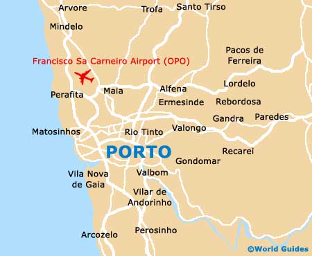
The historical heart of Porto can be found directly south of the Avenida dos Aliados, while to the east is an especially vibrant and appealing shopping district, based around the Rua Santa Catarina. To the west and next to the sea you will encounter the area referred to as 'New Porto', which encompasses the rather happening district of the Foz do Douro, next to the affluent neighbourhood of Matosinhos.
Separating the city centre from New Porto is the Boavista district, which has grown up around the Praça de Mouzinho de Albuquerque and comprises numerous hotels, office blocks, shopping centres and attractions, such as the Casa da Música. Maps of Porto are always highly recommended and are available at the tourist offices, along with bookstores around the Avenida dos Aliados, the Rua Santa Catarina, and also the Rua das Carmelitas.
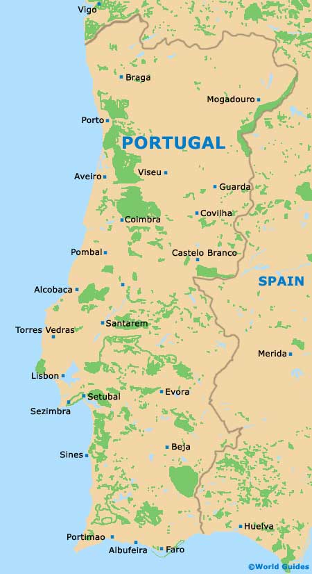
- Amarante - 62 km / 39 miles (one hour and five minutes, east)
- Aveiro - 77 km / 48 miles (one hour and ten minutes, south)
- Braga - 57 km / 35 miles (one hour, north-east)
- Chaves - 155 km / 96 miles (one hour and 45 minutes, north-east)
- Coimbra - 120 km / 75 miles (one hour and 25 minutes, south)
- Esposende - 53 km / 33 miles (50 minutes, north-west)
- Guarda - 202 km / 126 miles (two hours and 25 minutes, south-east)
- Guimaraes - 55 km / 34 miles (one hour, north-east)
- Lisbon (Lisboa) - 317 km / 197 miles (three hours and 15 minutes, south)
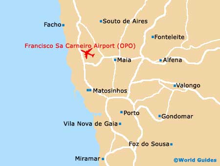
- Matosinhos - 10 km / 6 miles (15 minutes, north-west)
- Ponte de Lima - 85 km / 53 miles (one hour and 15 minutes, north)
- Santa Maria da Feira - 35 km / 22 miles (40 minutes, south)
- Sintra - 337 km / 209 miles (three hours and 35 minutes, south)
- Viana do Castelo - 75 km / 47 miles (one hour and ten minutes, north)
- Vila do Conde - 35 km / 22 miles (40 minutes, north)
- Vila Nova de Famalicao - 40 km / 25 miles (45 minutes, north)
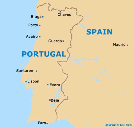
Map of Portugal
Map of Porto