Versailles Maps and Orientation
(Versailles, Ile-de-France, France)
A suburb of
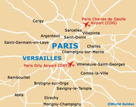
Paris, Versailles is considered to be a city / commune in its own right and home to an overall population rapidly approaching 100,000 residents. Versailles is situated just 20 km / 12 miles to the west of Paris, within the Île-de-France area, and enjoys a fairly elevated city, atop a spreading plateau.
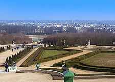
The natural scenery surrounding Versailles is especially beautiful and consists of a series of hills and woodlands. Apart from Paris, many interesting French cities and towns are extremely close by and so tourists often choose to stay here, using Versailles as a fairly central location to base themselves.
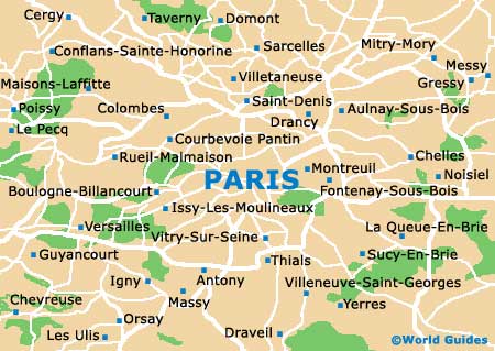
Maps and Orientation of the City
The actual layout of Versailles is incredibly organised, with a logical network of roads and avenues, forming a grid. This structure is quite historical and its present structure was the direct result of none other than the king of France himself, King Louis XIV.
Visitors will find the Palace of Versailles (Château de Versailles) easy to find and well signposted, being located on the western side of the city. For more tourist information and regional maps of France, the Office de Tourisme lies on the Bis Avenue de Paris and is open all through the year, except during the month of December. Guided walking tours of Versailles are always popular and can also be arranged here.
Office de Tourisme de Versailles
Address: 2 Bis Avenue de Paris, Versailles, FR-78000, France, FR
Tel: +33 01 3924 8888
Fax: +33 01 3924 8889
Email: tourisme@ot-versailles.fr
Open hours: April to September, Monday - 10:00 to 18:00, Tuesday to Sunday - 09:00 to 19:00; October to March, Sunday and Monday - 11:00 to 17:00, Tuesday to Saturday - 09:00 to 18:00
Nearby communes close to Versailles include the following locations:
- Antony, Hauts-de-Seine - 17 km / 11 miles (20 minutes, south-east)
- Argenteuil - 22 km / 14 miles (25 minutes, north)
- Boulogne-Billancourt - 12 km / 7 miles (15 minutes, east)
- Cergy - 48 km / 30 miles (45 minutes, north)
- Champigny-sur-Marne - 34 km / 21 miles (38 minutes, east)
- Chantilly - 65 km / 40 miles (one hours, north)
- Créteil - 30 km / 19 miles (32 minutes, east)
- Evry, Essonne - 39 km / 24 miles (35 minutes, south-east)
- Fountainebleau - 72 km / 45 miles (one hour and five minutes, south-east)
- Franconville, Val-d'Oise - 32 km / 20 miles (30 minutes, north)
- Massy, Essonne - 18 km / 11 miles (22 minutes, south-east)
- Nanterre - 15 km / 9 miles (17 minutes, north)
- Paris - 20 km / 12 miles (20 minutes, east)
- Poissy - 26 km / 16 miles (30 minutes, north)
- Taverny - 37 km / 23 miles (40 minutes, north)
- Vitry-sur-Seine - 26 km / 16 miles (30 minutes, east)
Map of France

Map of Paris and Versailles