Vantaa Maps and Orientation
(Vantaa, Uusimaa, Southern Finland, Finland)
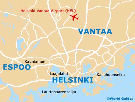
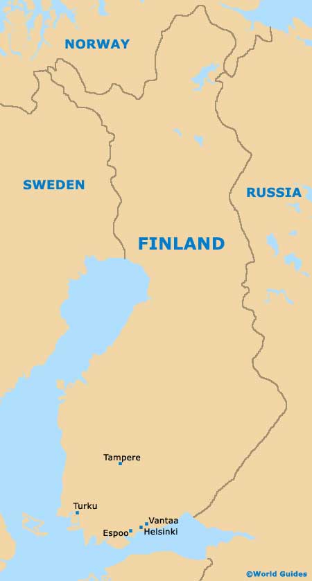
Located directly north of Helsinki, the city of Vantaa is actually a part of the Greater Helsinki area and resides within the Uusimaa region, close to Espoo. Vantaa has grown in size greatly in recent years and is now home to almost 200,000 inhabitants.
Widely considered by the Finnish to be a satellite of nearby Helsinki city, many of the Vantaa locals actually work in the Finnish capital and commute on a daily basis. Vantaa is also especially close to Espoo, which lies to the south-west, and to the municipality of Tuusula, to the north.
Maps and Orientation of the City
The city of Vantaa is split into five main districts, Hakunila (south-east), Korso-Koivukylä (north-east), Martinlaakso (west), Myyrmäki (south-west) and Tikkurila (central). Each of these districts is further divided into some 60 sub-districts and well connected by public transport.
Maps of the city are available at the bus station and also at Helsinki Vantaa Airport, which lies directly north of the city.
- Espoo - 29 km / 18 miles (35 minutes, south-west)
- Helsinki - 22 km / 14 miles (30 minutes, south)
- Hyvinkää - 53 km / 33 miles (one hour and five minutes, north)
- Järvenpää - 29 km / 18 miles (35 minutes, north)
- Karkkila - 76 km / 47 miles (one hour and 15 minutes, north-west)
- Kauniainen - 25 km / 16 miles (30 minutes, south-west)
- Kerava - 20 km / 12 miles (25 minutes, north)
- Lohja - 65 km / 40 miles (one hour and ten minutes, west)
- Mäntsäla - 50 km / 31 miles (55 minutes, north)
- Nurmijärvi - 34 km / 21 miles (40 minutes, north)
- Porvoo - 43 km / 27 miles (40 minutes, east)
- Riihimäki - 66 km / 41 miles (one hour and ten minutes, north)
- Sipoo - 23 km / 14 miles (30 minutes, north-west)
- Tuusula - 17 km / 11 miles (23 minutes, north)
- Vihti - 60 km / 37 miles (one hour, north-west)
Map of Finland
Map of Vantaa