Cambridge Maps and Orientation
(Cambridge, Cambridgeshire, England, UK)
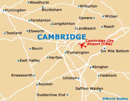
A beautiful city with an undeniable historical appearance, Cambridge started life as a Roman fortress and is today a famous university city known all over the world. Central Cambridge is where the main university buildings and colleges are located, lying around the sweeping curve of the River Cam.
Cambridge is easy to cover on foot or by bicycle, with the most familiar part of the River Cam being known as the 'Backs' and offering excellent views of the King's College Chapel, together with no less than six colleges. The bus station is to be found along Drummer Street, while the railway station is just a short walk away and to the south.
Maps and Orientation of the City
Sidney Street is a busy road in the city centre, leading towards St. Andrew's Street (south) and to Magdalene Street (north), where the main shops await. Maps of Cambridge are available at the Tourist Information Centre (TIC) on Wheeler Street. Walking tours depart here every day, throughout the year, and allow you to get a better feeling of how this beautiful city is laid out.
Map of the United Kingdom

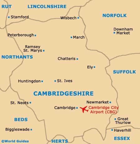
Map of Cambridgeshire
Map of Cambridge