Osijek Maps and Orientation
(Osijek, Slavonia, Croatia)
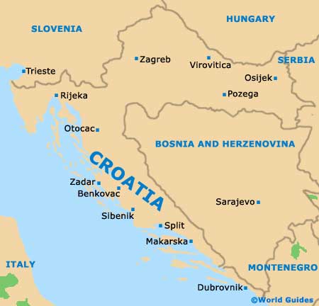
Osijek is right over in the eastern end of upper
Croatia, and by road is a little more than 280 km / 174 miles to the east of the capital city,
Zagreb. The Slavonia region's largest city, Osijek is just 30 km / 19 miles from the Hungarian border, which lies off to the north, and is about the same distance from the Serbian border, to the east.
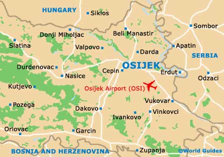
On Osijek maps, the city sits close to the meeting of the Danube and Drava rivers, actually residing on the south banks of the Drava. It is one of three cores, the Upper Town, the Lower Town and the old
Tvrda fortress. The latter is of most interest to tourists as this is where attractions, shops and entertainment options are mostly based.
Maps and Orientation of the City
The Tvrda area of Osijek is easily negotiated on foot, yet you will need maps for getting about as there is a warren of streets in this part of town. Maps are also needed for finding your way around the Upper Town, which itself is mainly focused on the Trg Ante Starcevica city square. There are several other interesting parts to Osijek, including the Trg Svetog Trojstva square and the Left Coast.
Maps of Osijek are available online in pocket or fold-out format and include the Slavonia area at large down to street level. You can also pick up city maps from the main Osijek Tourist Board office on the Zupanijska 2, next to the Croatian National Theatre and the Church of St. Peter and Paul. Alternatively, check with your hotel reception for a free map.
- Belgrade - 245 km / 152 miles (two hours and 45 minutes, south-east)
- Beli Manastir - 32 km / 20 miles (40 minutes, north)
- Belisce - 33 km / 21 miles (40 minutes, north-west)
- Bizovac - 20 km / 12 miles (30 minutes, west)
- Cepin - 9 km / 6 miles (15 minutes, south)
- Dakovo - 50 km / 31 miles (55 minutes, south-west)
- Darda - 13 km / 8 miles (20 minutes, north)
- Ernestinovo - 14 km / 9 miles (25 minutes, south)
- Ilok - 74 km / 46 miles (one hour and 15 minutes, south-east)
- Ivankovo - 40 km / 25 miles (50 minutes, south)
- Karanac Ethno Village - 31 km / 19 miles (40 minutes, north)
- Knezevi Vinogradi - 28 km / 17 miles (35 minutes, north-east)
- Kopacki Rit - 14 km / 9 miles (25 minutes, east)
- Osijek Airport - 20 km / 13 miles (30 minutes, south-east)
- Pecs - 90 km / 56 miles (one hour and 30 minutes, north-west)
- Semeljci - 29 km / 18 miles (35 minutes, south)
- Trpinja - 27 km / 17 miles (35 minutes, south-east)
- Valpovo - 27 km / 17 miles (35 minutes, north-west)
- Virovitica - 126 km / 78 miles (two hours, north-west)
- Vukovar - 40 km / 25 miles (50 minutes, south-east)
- Zagreb - 281 km / 175 miles (three hours and 40 minutes, west)
Map of Croatia
Map of Osijek