Guernsey Maps and Orientation
(Guernsey, Channel Islands, British Isles)
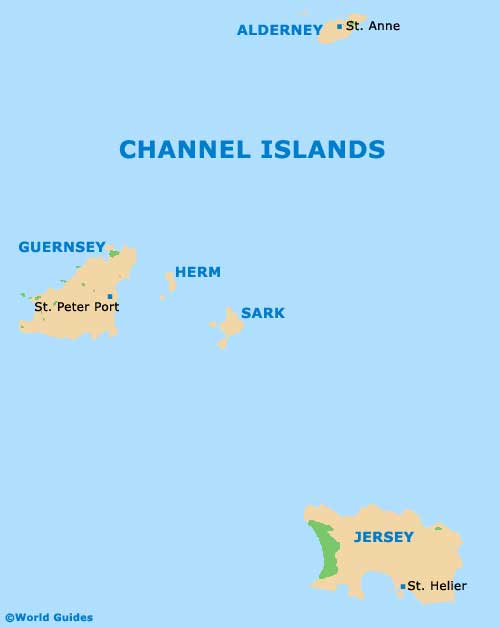
Located in the English Channel, within Saint Malo Bay and directly north-west of
Jersey, Guernsey lies just a short distance to the east of both the islands of Herm and Sark. Guernsey is the second largest of the
Channel Islands, although in reality is actually a relatively small island, being around 14.5 km / 9 miles in length and a mere 5 km / 3 miles wide.
Guernsey is situated some 113 km / 70 miles from the southern shoreline of
England, and just 48 km / 30 miles from north-eastern
France, being close to both St. Malo and Cherbourg. The island of Alderney can be found to the north-east and makes for a popular day trip.
Maps and Orientation of the Island
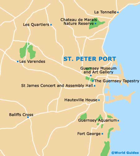
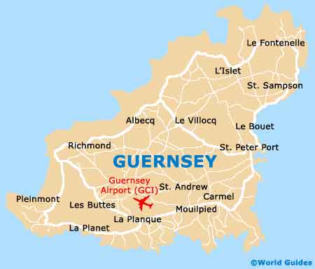
Due to its compact layout, Guernsey is easy to find your way around and you are guaranteed to be literally never more than minutes away from a beautiful beach, sandy bay or scenic coastal view. St. Peter Port is Guernsey's capital and this town has a population of approximately 17,000 residents.
The easterly coastline of St. Peter Port contains a number of low lying sandy beaches, becoming more elevated and hilly as you head southwards. However, for the best selection of sandy bays on Guernsey, you will need to head to the northern and western coastline, where Rocquaine Bay and Vazon Bay are hard to beat in terms of size and scenery.
Guernsey is divided into a total of ten parishes, shown below.
- Castel (west)
- Forest (south)
- Saint Andrew's (central)
- Saint Martin's (south-east)
- Saint Peter Port (east)
- Saint Pierre du Bois (south-west)
- Saint Sampson (north-east)
- Saint Saviour's (south-west)
- Torteval (south-west)
- Vale (north)
Map of the Channel Islands
Map of Guernsey
Map of St. Peter Port