Jerusalem Maps and Orientation
(Jerusalem, Israel)
Not only is Jerusalem the Israeli capital, but it is also the largest city within the whole of
Israel. Over 700,000 people live in Jerusalem and this ancient city is known to have such a long past that it is actually one of the oldest on the entire planet.
Jerusalem is a very holy city in the world of Judaism and other religions, such as both Islam and Christianity. The city lies within the very scenic Judean Mountains, where it is sandwiched by both the Dead Sea and the Mediterranean Sea.
Maps and Orientation of the City
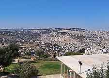
The historical Old City serves as a very important part of Jerusalem and although it is actually really quite small, is packed with religious landmarks, such as the Dock of the Rock and also the
Temple Mount. Surrounded by a well-preserved stonewall, Jerusalem's Old City now ranks as a World Heritage Site.
To get a feel for how the Old City is laid out, do take a walk along the top of the walls and ramparts, where you can enjoy excellent views across much of Jerusalem. The surrounding alleyways and markets will provide an enticing atmosphere, while for day-to-day village life, the suburb of Ein Kerem, on the westerly side of Jerusalem may be of interest, being known for its artisans, galleries, churches and the actual birthplace of John the Baptist.
- Abu Gosh - west
- Ashdod - west
- Bat Yam - west
- Beersheba - south-west
- Bethlehem - south
- Ein Gedi - south
- Hebron - south
- Jericho - east
- Masada - south
- Nablus - north
- Petah Tikva - north-west
- Ramia - north-west
- Ramallah - north
- Tel Aviv - north-west
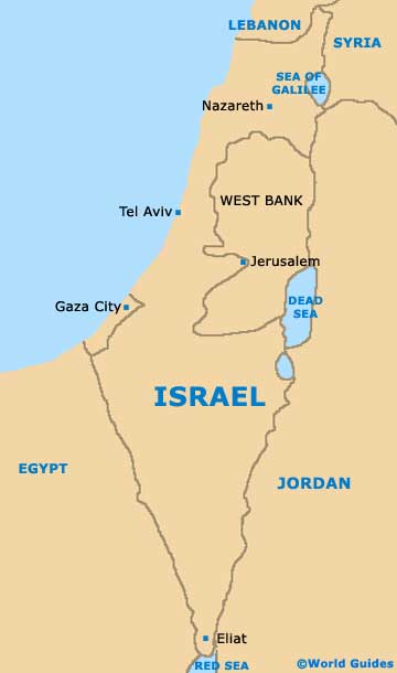
Map of Israel
Map of Jerusalem

