Maluku Maps and Orientation
(Maluku / Moluccan Islands, Indonesia)
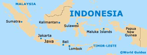
The Maluku Islands are a small Indonesian archipelago and also go by several different names, such as both the Spice Islands and the Moluccan Islands. Located directly to the east of
Sulawesi, many people also simply refer to the Maluku Islands as simply Maluku.
The landscape across the islands is fairly varied, with some mountainous areas and a number of active volcanoes. Maluku is divided into two north and south provinces, and comprises approximately 1,000 individual islands and islets.
Maps and Orientation of the Islands
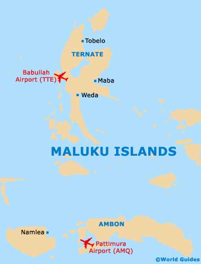
In the North Maluku Province, Ternate is the main island and is located to the west of the larger Halmahera island. Other prominent northerly islands include Bacan, Morotai, Tidore, the Obi Islands and also the Sula Islands.
The more southerly Maluku Province is where you will find Ambon Island - home of the Ambon seaport and serving as the provincial capital. Also forming part of this province are the islands of Aru, Babar, Banda, Kei (Kai), Leti and Tanimbar, as well as Buru, Kisar, Seram and Wetar.
- Darwin (Australia) - south
- Flores Islands (Pulau Flores) - south-west
- Halmabera Island (Pulau Halmabera) - north
- Komodo - south-west
- Papua - east
- Papua New Guinea - east
- Rinca - south-west
- Sulawesi - west
- Sumba Island (Pulau Sumba) - south-west
- Tanimbar Islands - south-east
- Timor Island - south
- Wetar Island (Pulau Wetar) - south
Map of Indonesia
Map of Maluku Islands