Yogyakarta Maps and Orientation
(Yogyakarta, Central Java, Indonesia)
The cultural hub that is Yogyakarta lies on the southerly side of Central Java, where it has become a thriving tourist city. Part of the Special Region of Yogyakarta, the city is often affectionately referred to as simply 'Yogya' and has become a leading centre for higher education in
Indonesia.
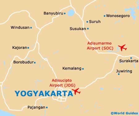
Yogyakarta is divided into a total of 14 different districts (kecematan), of which Kotagede, Kraton and Pakualaman (Paku Alaman) are especially prominent. Surrounding the Sultan's Palace, the Kraton neighbourhood is central to city life and is densely populated, being recently redeveloped and now known for being a tourist attraction in its own right.
Maps and Orientation of the City
It really is very simple to find your way around the city of Yogyakarta, even if you don't have a map, since the Jalan Malioboro is such an important central thoroughfare, running between the Kraton district and the railway station. To the south, the Jalan Malioboro leads into the Jalan Jenderal Ahmad Yani (Jalan A Yani).
- Banyubiru - 89 km / 55 miles (one hour and 40 minutes, north-east)
- Borobudur - 41 km / 25 miles (50 minutes, north-west)
- Jepara - 200 km / 124 miles (three hours and 50 minutes, north)
- Kajoran - 75 km / 47 miles (one hour and 45 minutes, north-west)
- Kandangan - 73 km / 45 miles (one hour and 20 minutes, north)
- Kemalang - 33 km / 21 miles (45 minutes, north-east)
- Magelang - 45 km / 28 miles (55 minutes, north-west)
- Pacitan - 180 km / 112 miles (four hours, south-east)
- Parangtritis - 25 km / 16 miles (35 minutes, south)
- Polokarto - 71 km / 44 miles (one hour and 20 minutes, north-east)
- Prambanan - 16 km / 10 miles (15 minutes, north-east)
- Rembang - 230 km / 145 miles (four hours and 15 minutes, north-east)
- Sadang - 98 km / 61 miles (two hours, north-west)
- Secang - 56 km / 35 miles (one hour and ten minutes, north)
- Semarang - 125 km / 78 miles (two hours and ten minutes, north)
- Solo (Surakarta) (Surakarta) - 66 km / 41 miles (one hour and 15 minutes, north-east)
- Surabaya - 330 km / 205 miles (six hours and 30 minutes, north-east)
- Tangen - 105 km / 65 miles (two hours, north-east)
- Windusari - 52 km / 32 miles (one hour and ten minutes, north-west)
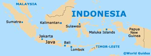
Map of Indonesia
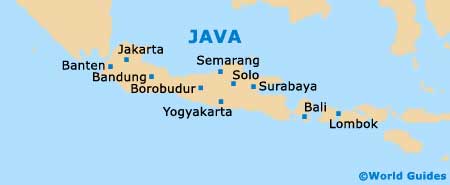
Map of Java
Map of Yogyakarta