Shenyang Maps and Orientation
(Shenyang, Liaoning, China)
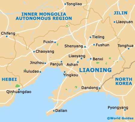
The city of Shenyang lies on the southern side of north-eastern China, standing close to North Korea to the east. Capital of the Liaoning Province, Shenyang has become an important and prosperous industrial centre and is home to a number of winding rivers, which include the Hun River and the Liao River.
On the southern side of Shenyang you will find the Liaodong Peninsula, which is home to the city of
Dalian and also the port of Lushun, often referred to as Port Arthur. The Liaodong Gulf lies directly south of Shenyang and is edged by Huludao, Jinzhou and Yingkou, amongst other locations.
Maps and Orientation of the City
Dotted around this bustling metropolis are a number of historic pagodas, tranquil temples and ancient tombs, often standing amongst more modern structures and high-rise buildings. Many roads encircle areas of the city, while some streets have become fully pedestrianised, with shopping in mind. A map is always an indispensable piece of luggage, with English maps available at the Liaoning Tourism Bureau on Huanghe Dajie, the Foreign Language Bookstore along Taiyuian Jie, and many of the biggest hotels, and also at local train stations.
Close to Shenyang and to the south-west, Dandong is a large city with a population exceeding two million people. Dandong is a popular excursion from Shenyang and stands near to the easternmost part of China's famous Great Wall. Also within close proximity to Shenyang are the following cities, towns and villages, together with the orientation.
- Anshan - south
- Benxi - south
- Changtu - north
- Dawa - south-west
- Fushun - east
- Fuxin - west
- Haicheng - south
- Liaoyang - south
- Tieling - north
- Xinmin - west
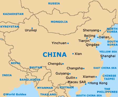
Map of China
Map of Liaoning
Map of Shenyang

