El Paso Maps and Orientation
(El Paso, Texas - TX, USA)
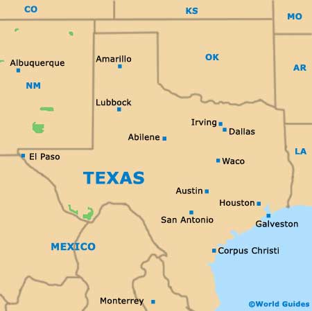
El Paso is located about as far westwards as you can get in the state of Texas, being close to the borders with both New Mexico (USA) and Chihuahua (
Mexico). Part of the Franklin Mountains, the North Franklin Mountain dominates the natural scenery and measures in at a little under 7,200 feet / 2,195 meters.
The city serves as the seat of El Paso County and is a part of the expansive El Paso-Las Cruces-Ciudad Juarez Metropolitan Area, which also comprises the cities of Juarez and Las Cruces.
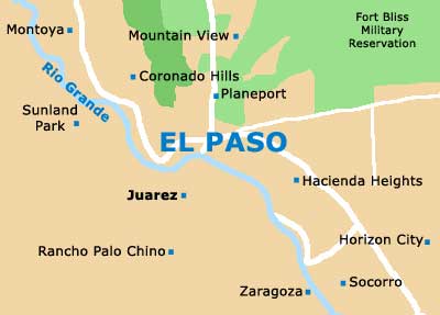
El Paso is roughly divided into eastern and western regions, being split by the Franklin Mountains State Park. The city's busy international airport lies to the east, while the University of Texas at El Paso (UTEP) is based to the west, being where you will find the Sun Bowl football stadium.
Maps and Orientation of the City
If you are planning to navigate your way around downtown El Paso, then you might like to look out for the El Paso Convention Center and Visitors Bureau, which resides on the One Civic Center Plaza, next to Santa Fe Street and the City Hall.
Nearby you will find the Performing Arts Center, the Abraham Chavez Theater and the Museum of History.
- Album -11 miles / 18 km (20 minutes, east)
- Ciudad Juarez - 5 miles / 8 km (12 minutes, south)
- Franklin Mountains State Park - 18 miles / 29 km (30 minutes, north)
- Kohlberg - 10 miles / 16 km (18 minutes, northwest)
- Morningside Heights - 6 miles / 10 km (12 minutes, north)
- Palomino - 16 miles / 26 km (25 minutes, northeast)
- Parcelas Ejido Jesus Carranza - 16 miles / 26 km (25 minutes, southeast)
- Pecan Grove - 15 miles / 24 km (25 minutes, southeast)
- Puerto de Anapra - 11 miles / 18 km (20 minutes, west)
- Socorro - 16 miles / 26 km (25 minutes, southeast)
- Sunland Park North - 8 miles / 13 km (15 minutes, northwest)
- Thomas Manor - 9 miles / 14 km (15 minutes, southeast)
- Toribio Ortega - 13 miles / 21 km (22 minutes, south)
- Valley Creek North - 14 miles / 23 km (25 minutes, northwest)
- Vista Hills - 13 miles / 21 km (22 minutes, east)
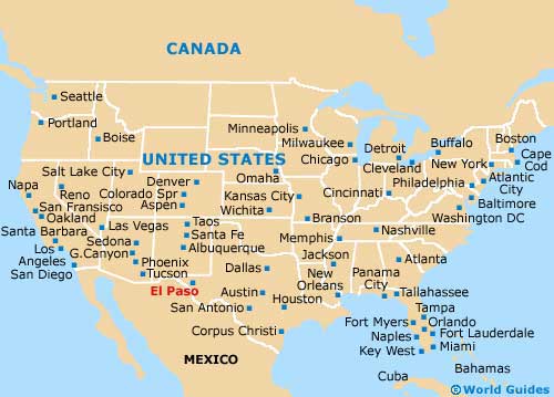
Map of the United States

Map of Texas

Map of El Paso


