Chattanooga Maps and Orientation
(Chattanooga, Tennessee - TN, USA)
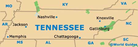
Chattanooga lies on the southeasterly side of Tennessee, close to the state border with
Georgia. This city is the state's fourth-biggest city and the largest in Hamilton County, where it is also the county seat.
Based around the lakes of Chickamauga and Nickajack, both of which are fed by the Tennessee River, the city of Chattanooga offers a wealth of recreational activities, including plenty of water sports and rock-climbing opportunities.
Chattanooga was known for its extensive industrial pollution back in the sixties, although that image is long gone. The city is now clean and green, with many lengthy waterfront trails and even a network of free electric shuttle buses.
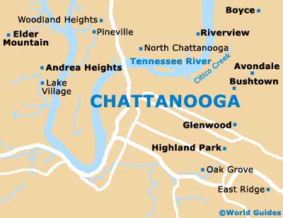
Maps and Orientation of the City
Sightseers armed with a map and looking for interest will find many attractions spread around the city, with downtown Chattanooga being a good place to start any exploration.
For shopping and riverside dining, the Bluff View Art District is worth searching out, being based around East Street and High Street. If you are in the mood for a stroll along the banks of the Tennessee River, then Coolidge Park on the north shore is the perfect starting point. Roughly 6 miles / 10 km outside of Chattanooga are the attractions of Lookout Mountain, which include the Incline Railway, the landscaped gardens of Rock City, and the giant underground waterfall known as the Ruby Falls.
- Atlanta, (GA) - 118 miles / 190 km (two hours and 40 minutes, southeast)
- Birmingham (AL) - 145 miles / 233 km (three hours and 25 minutes, southwest)
- Crossville - 79 miles / 127 km (one hour and 50 minutes, north)
- Decatur - 125 miles / 201 km (two hours and 50 minutes, southwest)
- Fayetteville - 95 miles / 153 km (two hours and 15 minutes, west)
- Franklin - 132 miles / 212 km (three hours, northwest)
- Huntsville - 98 miles / 158 km (two hours and 15 minutes, west)
- Knoxville - 112 miles / 180 km (two hours and 35 minutes, northeast)
- Murfreesboro - 101 miles / 163 km (two hours and 30 minutes, northwest)
- Nashville - 133 miles / 214 km (three hours, northwest)
- Prentice Cooper State Forest and Wildlife Management Area - 12 miles / 19 km (20 minutes, northwest)
- Rock Spring - 18 miles / 29 km (30 minutes, south)
- Sale Creek - 28 miles / 45 km (45 minutes, north)
- Shelbyville - 103 miles / 166 km (two hours and 30 minutes, west)
- Soddy Daisy - 17 miles / 27 km (25 minutes, north)
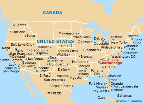
Map of the United States
Map of Tennessee
Map of Chattanooga