Asheville Maps and Orientation
(Asheville, North Carolina - NC, USA)
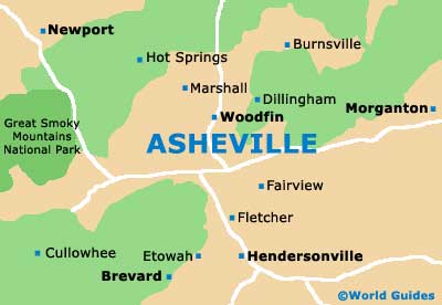
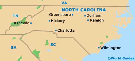
Located on the western side of North Carolina, the city of Asheville lies close to the state border with
Tennessee and within the county of Buncombe, where it is the county seat.
The city belongs to the expansive Asheville Metropolitan Statistical Area, which incorporates the counties of Buncombe, Haywood, Henderson and Madison. The largest cities and towns based within the metro area include Black Mountain, Canton, East Flat Rock, Fletcher, Hendersonville, Mills River, Swannanoa, Waynesville and Woodfin.
Ashville enjoys a particularly pleasant and scenic setting, being sited within the Blue Ridge Mountains and next to the Swannanoa and the French Broad rivers. Interstates I-40 and I-240 loop around the southside section of Asheville, while the I-26 (US-23 / US-70) heads northwards to Woodfin, Stoney Knob, Weaverville and Mars Hill.
Maps and Orientation of the City
The city center is relatively compact and visitors will generally find it easy to self-navigate. There are plenty of shops to explore and restaurants to enjoy. For something more 'gritty', the neighborhood of West Asheville is worth a look.
If you are struggling to find your way around the city, then pay a visit to the Asheville Convention and Visitors Bureau to pick up a free map or two. The bureau is to be found on Montford Avenue, close to the city's Chamber of Commerce and the Historic Trolley Tours. Staff here will be happy to provide maps and directions, and help you plan your itinerary, complete with their insider knowledge.
- Arden - 13 miles / 21 km (25 minutes, south)
- Bear Creek - 4 miles / 6 km (ten minutes, west)
- Biltmore Park - 12 miles / 19 km (20 minutes, south)
- Black Mountain - 15 miles / 24 km (25 minutes, east)
- Deer Run - 12 miles / 19 km (20 minutes, south)
- Haw Creek - 4 miles / 6 km (ten minutes, east)
- Hendersonville - 26 miles / 42 km (45 minutes, south)
- Malvern Hills - 5 miles / 8 km (12 minutes, southwest)
- Mars Hill - 19 miles / 31 km (30 minutes, north)
- Norwood Park - 1.5 miles / 2.5 km (five minutes, north)
- Oak Park (Blake Mountain Estates) - 12 miles / 19 km (20 minutes, south)
- Oakley - 5 miles / 8 km (12 minutes, southeast)
- Stoney Knob - 8 miles / 13 km (15 minutes, north)
- Swannanoa - 10 miles / 16 km (18 minutes, east)
- Weaverville - 10 miles / 16 km (18 minutes, north)
- Woodfin - 5 miles / 8 km (12 minutes, north)
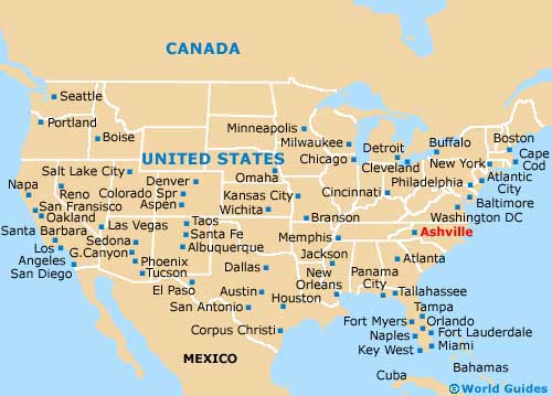
Map of the United States
Map of North Carolina
Map of Asheville