Annapolis Maps and Orientation
(Annapolis, Maryland - MD, USA)
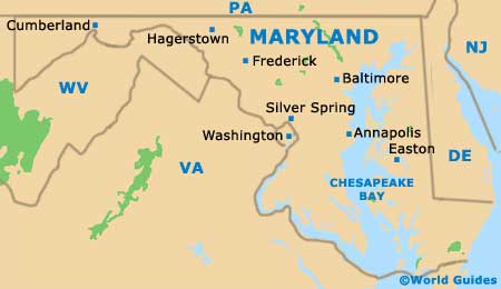
Located in central Maryland and alongside Chesapeake Bay, the city of Annapolis stands within the county of Anne Arundel, where it is the county seat. However, the largest city in Anne Arundel County is actually Glen Burnie, which boasts a population in the region of 70,000 people, while just under 40,000 currently live in Annapolis.
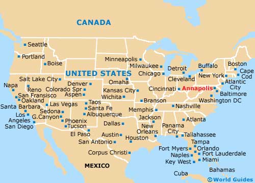
The city stands at the mouth of the meandering Severn River, being sited roughly 45 minutes to the south of Baltimore and slightly less than an hour to the east of Washington DC. To the north of the city, the Baltimore-Annapolis Boulevard (MD Route 450) crosses the bay, connecting the Forrest Sherman Field with the Jonas Green State Park and leading to the Governor Ritchie Highway.
Annapolis is a relatively small city, being centered around the Maryland State House and its State Circle. From this point a number of roads radiate outwards, leading to Main Street, West Street, College Avenue, King George Street and the Duke of Gloucester Street.
Maps and Orientation of the City
If you are looking for maps of Annapolis, then visitors centers can be found at the State House and at the City Dock on West Street, close to St. Anne's Episcopal Church. Alternatively, most of the larger hotels should be able to provide you with maps or give you directions to your chosen destination.
The northern side of Annapolis is bounded by College Creek, which lies next to St. John's College and the Worden Field, with Spa Creek being found to the south, along with the Marriott Waterfront Hotel and the Annapolis Yacht Club.
- Arnold - 5 miles / 8 km (ten minutes, north)
- Baltimore - 30 miles / 48 km (45 minutes, north)
- Beltsville - 29 miles / 47 km (50 minutes, west)
- Bowie - 20 miles / 32 km (35 minutes, west)
- Cape St. Claire - 8 miles / 13 km (15 minutes, northeast)
- Crownsville - 8 miles / 13 km (15 minutes, northwest)
- Edgewater - 11 miles / 18 km (20 minutes, southwest)
- Glen Burnie - 16 miles / 26 km (25 minutes, north)
- Herald Harbor - 9 miles / 14 km (20 minutes, northwest)
- Highland Beach - 5 miles / 8 km (ten minutes, southeast)
- Hillsmere Shores - 3 miles / 5 km (ten minutes, south)
- Londontowne - 7 miles / 11 km (12 minutes, southwest)
- Odenton - 17 miles / 27 km (30 minutes, northwest)
- Parole - 4 miles / 6 km (ten minutes, west)
- Severna Park - 9 miles / 14 km (20 minutes, north)
- Silver Spring - 34 miles / 55 km (55 minutes, west)
- Skidmore - 8 miles / 13 km (15 minutes, northeast)
- South Laurel - 27 miles / 43 km (45 minutes, northwest)
- Washington DC - 33 miles / 53 km (55 minutes, west)
Map of the United States
Map of Maryland
Map of Annapolis

