Lexington Maps and Orientation
(Lexington, Kentucky - KY, USA)
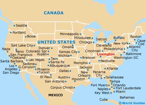
Lexington is situated on the northern side of Kentucky, roughly two hours to the south of Cincinnati, Ohio. The city serves as the state's second-biggest and resides within Fayette County, where it is the proud county seat.
Sightseers in Lexington should note that since there are so many attractions based on the outskirts of the city, a rental car and map will ensure that you make the most of your time here.
Interstate I-75 heads north to south, while the I-64 connects Lexington with destinations to the east (Hillsboro, Emerson, Summit and Huntington) and west (
Frankfort, Shelbyville and Louisville).
Maps and Orientation of the City
For maps and general advice about the best way to explore this part of Kentucky, head to the Lexington Convention and Visitors Bureau, which is located on West Main Street, close to the Children's Theater and the Explorium, and just a stroll away from the Catholic Church of St. Paul.
- Cincinnati - 84 miles / 135 km (two hours, north)
- Columbia - 12 miles / 19 km (20 minutes, east)
- Flemingsburg - 59 miles / 95 km (one hour and 30 minutes, northeast)
- Frankfort - 26 miles / 42 km (45 minutes, northwest)
- Harrodsburg - 32 miles / 51 km (50 minutes, south)
- Huntington - 127 miles / 204 km (three hours, east)
- Jimtown - 14 miles / 23 km (25 minutes, northeast)
- Keene - 11 miles / 18 km (15 minutes, southwest)
- Kentucky Horse Park - 9 miles / 14 km (15 minutes, north)
- Lawrenceburg - 24 miles / 39 km (40 minutes, west)
- Louisville - 75 miles / 121 km (one hour and 40 minutes, west)
- Meadowthorpe - 3 miles / 5 km (five minutes, north)
- Mount Sterling - 36 miles / 58 km (50 minutes, east)
- Nicholasville - 12 miles / 19 km (20 minutes, south)
- Pine Meadows - 4 miles / 6 km (ten minutes, west)
- Walton - 65 miles / 105 km (one hour and 35 minutes, north)
- Winchester - 19 miles / 31 km (35 minutes, east)
Map of the United States
Map of Kentucky

Map of Lexington

