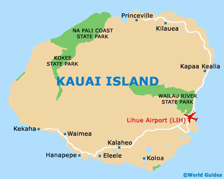
Kauai Maps and Orientation
(Kauai, Hawaii - HI, USA)
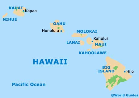
One of Hawaii's four major islands, along with
Maui, Oahu an the
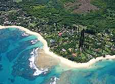
Big Island, Kauai enjoys a very undeveloped appearance, with many areas of extreme natural beauty. Kauai is also the oldest of the islands of Hawaii and is home to some stunning features, including its dominating volcanic peak of Mount Waialeale, and also its wondrous Na Pali shoreline and Waimea Canyon.
Maps of Kauai will clearly illustrate how different is island is to the others in Hawaii. The road structure remains quite basic, due in no small part to the natural obstacles which present themselves. Those driving along the island's southern coastline to reach the Waimea Canyon will only have a choice of either continuing along basic dirt roads towards the Polihale Beach, or simply turning back. A similar situation is apparent on the northern side of Kauai, on the road leading to Princeville.
Maps and Orientation of the Island
In general, Kauai is divided into five regions: the North Shore (home to the Na Pali Coast and Hanalei Bay), the West Side (containing the Waimea Canyon and the Polihale Heiau), the South Shore (with the beaches of Mahaulepu and Poipu), the Lihue-Wailua region, and the Coconut Coast.
Lihue is the island capital and can be found on the south-eastern side of Kauai. The Kauai Visitors Bureau is located here and is a good place to pick up island maps and brochures. Other notable towns include:
- Kappa - on the eastern side of Kauai, on the Coconut Coast and home to the island's largest population
- Poipu - the most noteworthy resort area and on the southern side of the island. Poipu is known for its beaches and water sports, including year-round snorkelling and summer surfing
- Princeville - a very exclusive northerly resort, with a number of outstanding golf courses
- Waimea - a small town located on the western side of Kauai, often passed by those headed to the Waimea Canyon
Map of the United States

Islands of Hawaii Map
Map of Kauai