Dover Maps and Orientation
(Dover, Delaware - DE, USA)
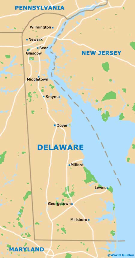
The state of Delaware resides on the far eastern side of North America and features Dover as its capital city. This is actually the state's second-biggest city and has a population of around 40,000 people, compared to roughly 75,000 people living in Delaware's larger city of Wilmington.
Dover also serves as the county seat for Kent County and has grown up around the St. Jones River, which bounds the eastern side of the city center. The river is lined by a number of spacious green spaces, such as the Memorial Park and Silver Lake Park.
A little to the east of downtown Dover is the US-13, which runs in a north to south direction, connecting Smyrna to the north and Woodside, Felton and Harrington to the south. Delaware Bay lies further to the east and offers all kinds of waterfront attractions, mixing with waters of the Atlantic Ocean.
Maps and Orientation of the City
Dover is not an especially large state capital and therefore finding your way around the city center is generally quite easy, particularly if you have brought some good maps with you. Most roads are straight and intersect with each other to make square or rectangular blocks.
State Street is a prominent thoroughfare in downtown Dover, heading north to south, while Division Street crosses State Street and runs east to west. Tourists should note that 'The Green' on South State Street is an important central location in the city, from which all attractions radiate outwards.
- Bombay Hook National Wildlife Refuge - northeast
- Delaware Bay - east
- Easton, Maryland (MD) - southwest
- Felton - south
- Georgetown - south
- Harrington - south
- Killens Pond State Park - south
- Middletown - north
- Milford - south
- Millsboro - south
- Newark - north
- Seaford - south
- Smyrna - north
- Wilmington - north
- Woodside - south
Map of USA
Map of Delaware
Map of Dover
