Denver Maps and Orientation
(Denver, Colorado - CO, USA)
Lying within the state of Colorado, the cosmopolitan city of Denver serves as both the state capital and the state's biggest city. Denver is located in the county of the same name, being a sizeable city with a population now topping 600,000 people, while its metropolitan population has recently exceeded 2.5 million.
Partly bounded by Broadway and the Colfax Avenue, the Downtown district is filled with towering skyscrapers, while the Lower Downtown area (LoDo) of Denver offers more in the way of history, along with a number of breweries and a lively dining scene. LoDo is also where you will find the popular 16th Street Mall and its huge concentration of shops.
Sightseers should note that the majority of the city's principal attractions are to be found within the Downtown district, as well as numerous hotels. Less than 30 minutes away are a number of surrounding suburb towns and cities, including the likes of Arvada,
Aurora, Centennial, Englewood, Lakewood, Thornton and Westminster.
Maps and Orientation of the City
Those in need of maps should first pay a visit to the Denver Visitor Center, which is just a few blocks away from the Colorado Convention Center, the University of Colorado Denver Auraria Campus and the Denver Center for the Performing Arts. Most bookstores also sell a good selection of maps, including those of popular publisher Rand McNally.
- Arvada - 11 miles / 18 km (20 minutes, northwest)
- Aspen - 198 miles / 319 km (five hours and 15 minutes, southwest)
- Aurora - 10 miles / 16 km (20 minutes, east)
- Boulder - 30 miles / 48 km (45 minutes, northwest)
- Broomfield - 17 miles / 27 km (30 minutes, northwest)
- Centennial - 14 miles / 23 km (25 minutes, south)
- Colorado Springs - 71 miles / 114 km (one hour and 50 minutes, south)
- Edgewater - 6 miles / 10 km (12 minutes, west)
- Englewood - 9 miles / 14 km (15 minutes, south)
- Estes Park - 65 miles / 105 km (one hour and 40 minutes, northwest)
- Greenwood Village - 13 miles / 21 km (25 minutes, south)
- Lakewood - 8 miles / 13 km (15 minutes, southwest)
- Littleton - 10 miles / 16 km (20 minutes, south)
- Northglenn - 12 miles / 19 km (20 minutes, north)
- Sherrelwood - 8 miles / 13 km (20 minutes, north)
- Thornton - 11 miles / 18 km (20 minutes, north)
- Westminster - 9 miles / 14 km (20 minutes, north)
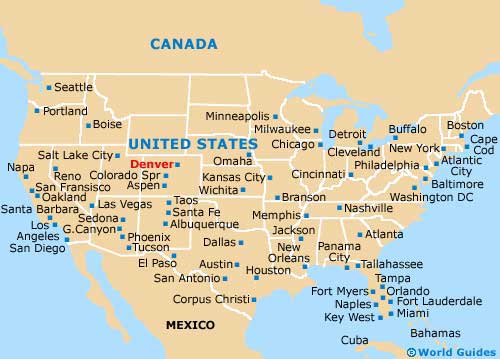
Map of the United States
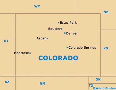
Map of Colorado
Map of Denver

