Phoenix Maps and Orientation
(Phoenix, Arizona - AZ, USA)
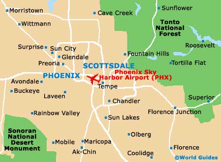
Forming the biggest urban area within America's Southwest, the city of Phoenix resides close to the heart of Arizona, being located within the Sonoran Desert and serving as the seat of Maricopa County. Phoenix actually ranks amongst America's biggest cities in terms of land size and boasts an enormous metropolitan area.
Surrounded by towering mountain ranges, several suburb towns and cities come together to make the metropolitan area named Greater Phoenix (or 'Valley of the Sun'), with the city forming the core. These 'suburbs' include the likes of
Mesa,
Scottsdale and Tempe, as well as Chandler, Gilbert, Glendale, Peoria and Surprise.
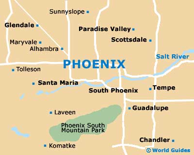
In the city of Phoenix itself, Central Avenue heads north to south, roughly dividing east from west. In the city center, Washington Street is a prominent thoroughfare heading east to west, running parallel with the Papago Freeway / Interstate I-10 (north) and the Maricopa Freeway / Interstate I-17 (south).
Maps and Orientation of the City
For maps of the city and state, as well as general tourist information, you may like to pay a visit to either the Greater Phoenix Convention and Visitors Bureau on East Van Buren Street, or the Downtown Phoenix Visitor Information Center on North 2nd Street, close to the Hyatt Regency Hotel and the city's Symphony Hall.
Further tourist outlets are situated within Mesa (on North Center Street), Scottsdale (on North Scottsdale Road) and Tempe (on West 3rd Street).
- Apache Junction - 36 miles / 58 km (one hour, east)
- Avondale - 19 miles / 31 km (30 minutes, west)
- Casa Grande - 49 miles / 79 km (one hour and 30 minutes, south)
- El Mirage - 27 miles / 43 km (45 minutes, northwest)
- Estrella Mountain Regional Park - 38 miles / 61 km (one hour and ten minutes, southwest)
- Flagstaff - 146 miles / 235 km (three hours and 30 minutes, north)
- Gilbert - 22 miles / 35 km (40 minutes, southeast)
- Glendale - 10 miles / 16 km (20 minutes, northwest)
- Mesa - 19 miles / 31 km (30 minutes, east)
- Peoria - 14 miles / 23 km (25 minutes, northwest)
- Phoenix South Mountain Park - 8 miles / 13 km (15 minutes, south)
- Scottsdale - 12 miles / 19 km (20 minutes, northeast)
- Sedona - 116 miles / 187 km (three hours, north)
- Sonoran Desert National Monument - 71 miles / 114 km (one hour and 50 minutes, southwest)
- Sun City - 23 miles / 37 km (40 minutes, northwest)
- Sun Tan Valley - 45 miles / 72 km (one hour and 20 minutes, southeast)
- Tempe - 11 miles / 18 km (20 minutes, east)
- White Tank Mountain Regional Park - 40 miles / 64 km (one hour and 15 minutes, west)
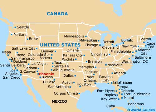
Map of the United States
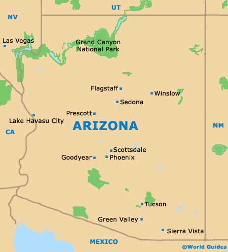
Map of Arizona
Map of Phoenix