Grand Canyon Maps and Orientation
(Grand Canyon, Arizona - AZ, USA)
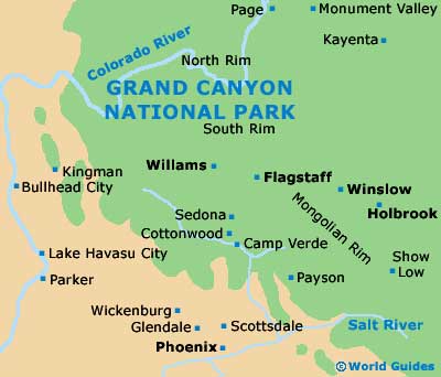
Located within the state of Arizona and the result of centuries of erosion caused by the meandering Colorado River, the world-famous Grand Canyon is a hugely popular American tourist destination. A giant fissure within the Colorado Plateau, the canyon itself is a part of the Grand Canyon National Park and understandably ranks as one of the world's natural wonders.
Lying in the South Rim area, the Grand Canyon Village forms the park's principal draw for tourists, being fairly well developed and close to the South Entrance Station, which is just a few miles to the south.
It is in this village where you will find the principal Visitors Center, where regional maps and tourist advice can be readily obtained. However, free maps and visitor guides will generally be dispensed upon your entrance to the park, along with information about free guided walks led by experienced rangers.
Maps and Orientation of the City
The Grand Canyon belongs to the Colorado River basin, an area which has been some 40 million years in the making.
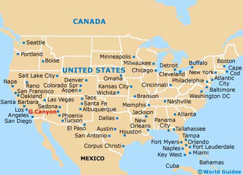
Since the Grand Canyon is relatively remote, if you are planning to visit surrounding Arizona cities, you will be in for a fair trek, unless you plan to fly by helicopter - no doubt enjoying some truly breathtaking bird's eye views along the way.
- Ash Fork - 79 miles / 127 km (two hours, south)
- Cedar City - 282 miles / 454 km (six hours, northwest)
- Colorado City - 220 miles / 354 km (five hours, northwest)
- Flagstaff - 79 miles / 127 km (two hours, south)
- Fredonia - 205 miles / 330 km (four hours and 30 minutes, north)
- Gallup - 260 miles / 418 km (five hours and 30 minutes, east)
- Glen Canyon National Recreation Area - 295 miles / 475 km (six hours and 30 minutes, northeast)
- Henderson - 250 miles / 402 km (five hours and 30 minutes, west)
- Las Vegas - 265 miles / 426 km (five hours and 40 minutes, west)
- Page - 139 miles / 224 km (three hours and 15 minutes, northeast)
- Prescott - 128 miles / 206 km (three hours, south)
- Sedona - 108 miles / 174 km (two hours and 40 minutes, south)
- St. George - 280 miles / 451 km (six hours, northwest)
- Sun Tan Valley - 270 miles / 435 km (five hours and 45 minutes, south)
- Sunrise Manor - 269 miles / 433 km (five hours and 45 minutes, west)
- Tuba City - 82 miles / 132 km (two hours and ten minutes, east)
- Winslow - 140 miles / 225 km (three hours and 15 minutes, southeast)
Map of the United States
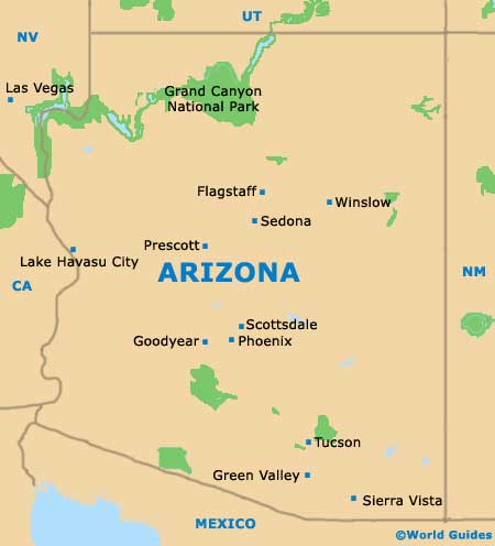
Map of Arizona
Map of Grand Canyon