Juliaca Maps and Orientation
(Juliaca, Puno, Peru)
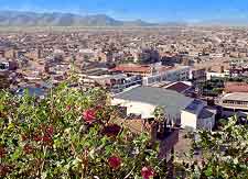
The city of Juliaca is to be found within the Puno area of southern
Peru, where it enjoys a scenic and elevated setting on the Altiplano plateau. Relatively close to the Bolivia border and right next to the world-famous attraction that is Lake Titicaca, Juliaca stands just over 3,800 metres / 12,465 feet above sea level.
Whilst Juliaca is far from being a leading Peruvian tourist destination, its proximity to Lake Titicaca and the city of Puno means that a fair few tourists pass through its streets. The city itself is well developed and convenient for excursions to many interesting neighbouring villages, as well as the famed pre-Inca burial ground of Sillustani, and is currently called home by some 200,000 residents.
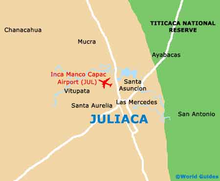
Maps and Orientation of the City
Juliaca is quite literally surrounded by places of interest, meaning that maps will prove essential for those wishing to get to grips with their bearings. Of note, the local Post Office is within walking distance of the Plaza Bolognesi and lies to the north-west, on the San Roman. The Plaza Bolognesi is situated directly opposite Juliaca's train station and alongside the Manuel Numez street.
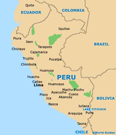
- Arequipa - west
- Arica - south
- Chucuito - south-east
- Cusco - north
- Cutimbo - south
- Desaguadero - south-east
- Guaqui - south-east
- Ilo - south-west
- Isla Taquille - south
- Lake Titicaca - east
- Lampa - north-west
- Machu Picchu - north
- Matarani - south-west
- Moquegua - south
- Nazca - west
- Pucara - north-west
- Puno - south
- Tacna - south
Map of Peru
Map of Juliaca