Huancayo Maps and Orientation
(Huancayo, Junin, Peru)
A large city located just to the south of central
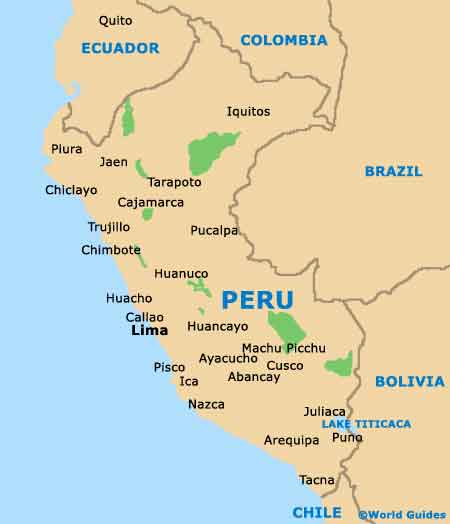
Peru, Huancayo lies within the Junin region of the Central Highlands, where it has become the proud capital. Huancayo is also the capital of the Huancayo Province and is conveniently near to the Rio Mantaro Valley, where it stands at an altitude of some 3,300 metres / 10,825 feet.
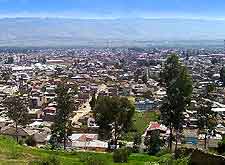
Currently the population of Huancayo is rapidly approaching 400,000 people and this city is now a top commercial centre, leading the area known as the Peruvian Andes. This is a large and spreading city, and so it is very likely that you will spend much of your time walking between places of interest, and therefore maps often prove quite invaluable.
Maps and Orientation of the City
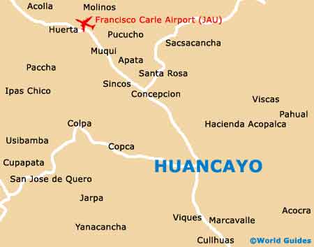
Central Huancayo is very much dominated by the Plaza de la Constitucion, with buses regularly arriving here, on the square's northerly and southerly sides. The Plaza de la Constitucion is surrounded by modern buildings and its central fountains serve as a convenient place to meet up. On the northern side of the city, the Rio Shulas is a prominent river and useful further landmark.
Huancayo's tourist office is sited on the major thoroughfare known simply as the Real, which runs in a north-westerly / south-easterly direction through the city, passing by the western side of the Plaza de la Constitucion. Maps are available at the tourist office, along with general information about how to get around the Rio Mantaro Valley.
- Abancay - south-east
- Ayacucho - south-east
- Callao - west
- Castrovirreyna - south
- Huacho - north-west
- Huancavelica - south
- Jauja - north
- Ica - south-west
- Lima - west
- Nazca - south
- Palcamayo - north-west
- Pampas - south
- Pisco - south
- Tarma - north
Map of Peru
Map of Huancayo