Porto Alegre Maps and Orientation
(Porto Alegre, Rio Grande do Sul, Brazil)
Located on the southern side of
Brazil, within the Rio Grande do Sul, the city of Porto Alegre serves as the state capital. Porto Alegre was established in the middle of the 18th century, when settlers arrived from the Portuguese archipelago of Azores.
Now home to a population of approximately 1.5 million residents, Porto Alegre resides on the eastern shore of the Guaiba Lake (Rio Guaiba), close to a series of islands and at the point where five rivers meet to form the expansive Lagoon of the Ducks (Lagoa dos Patos).
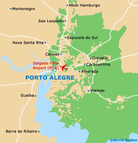
Maps and Orientation of the City
The heart of Porto Alegre is very much based around the Public Market, which is known locally as the Mercado Publico and is also an important transport hub. The Mercado Publico's tourist office is a good source of city maps, as is the bookstore on the Rua dos Andradas. Nest door, the Praca XV de Novembro is a spacious public square and important centrepiece.
Situated some 3 km / 2 miles to the east of Porto Alegre city centre is the lively shopping district of Moinhos de Vento, where nightlife is also a major attraction. The city park named the Praia de Belas lies on the southern side of the city, alongside the shoreline of the lake, and regularly draws the crowds on a sunny day.
- Alvorada - 22 km / 14 miles (30 minutes, east)
- Bento Goncalves - 130 km / 81 miles (two hours and 25 minutes, north)
- Cachoeirinha - 20 km / 12 miles (30 minutes, north-east)
- Canela - 130 km / 81 miles (two hours and 25 minutes, north-east)
- Canoas - 15 km / 9 miles (20 minutes, north)
- Caxias do Sul - 129 km / 80 miles (two hours and 15 minutes, north)
- Dois Irmaos - 58 km / 36 miles (one hour and 30 minutes, north)
- Estancia Velha - 49 km / 30 miles (one hour and 15 minutes, north)
- Esteio - 30 km / 19 miles (40 minutes, north)
- Farroupilha - 112 km / 70 miles (two hours and five minutes, north)
- Gramado - 125 km / 78 miles (two hours and 15 minutes, north)
- Gravatai - 29 km / 18 miles (40 minutes, north-east)
- Nova Santa Rita - 27 km / 17 miles (35 minutes, north)
- Novo Hamburgo - 42 km / 26 miles (one hour, north)
- Portao - 47 km / 29 miles (one hour and ten minutes, north)
- Sao Leopoldo - 33 km / 21 miles (45 minutes, north)
- Sapucaia do Sul - 29 km / 18 miles (40 minutes, north)
- Taquara - 83 km / 52 miles (one hour and 45 minutes, north-east)
- Viamao - 43 km / 27 miles (one hour, south-east)
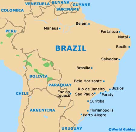
Map of Brazil
Map of Rio Grande do Sul

Map of Porto Alegre